
Italy Regional Road Maps | Detailed, Travel, Tourist, Driving
|
Italy Regional Road Maps |
|
TOURING CLUB ITALIANO MAPS |
Italy Regional Maps
- $17.95
Item Code : FREY9588
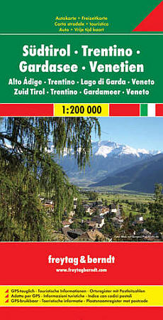
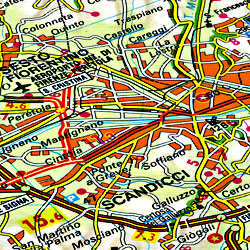
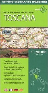
 Scale 1:200,000. Size 34"x44". Freytag & Berndt edition.
 - $17.95
Item Code : MRCO7718
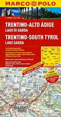
Scale 1:200,000. This This Marco Polo map of the Trentino & South Tyrol area features really easy to read cartography. Topography is highlighted with relief shading and loads of spot heights and the road network is clearly shown with roads ranging from motorways all the way through to minor secondary roads. The map also clearly indicates airports, places of interest, scenic/tourist routes, view points etc.
The map includes a booklet attached to the cover that contains some useful information and a very extensive index that covers locations, places of interest and geographical features. Also included are a distance/driving time chart and a fold out flap on the cover with an overview map of the region covered. A unique feature of the Marco Polo maps is "mark it" stickers, a set of seven reusable stickers (ie they don't damage the map when removed and placed elsewhere) that can be used to highlight interesting places, the route you plan to take (to make navigation easier), or whatever you want really. The legend is in a multitude of languages including English.
- $18.95
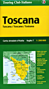
Item Code : TOUR9536
Trentino and the Tyrol Regions (Bolzano-Verona). - $16.95
Item Code : NATL21056
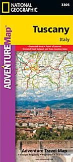
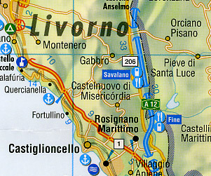
 Scale 1:200,000. Size 26"x38". National Geographic edition. National Geographic's Tuscany Adventure Map is designed to meet the unique needs of adventure travelers—detailed, durable, and accurate. Tuscany includes the locations of thousands of cities and towns with an index for easily locating them, plus a clearly marked road network complete with distances and designations for expressways, motorways, scenic routes, and more. What sets National Geographic Adventure Maps apart from traditional road maps are the hundreds of points of interest that highlight the diverse and unique destinations within Tuscany. Archeological sites, menhirs and other sites of interest from monuments, palaces, and castles to churches, chapels, and monasteries are noted making this map indispensable for travelers seeking to explore the region’s rich history. Users will find a variety of helpful travel aids on our map as well, including the location of airports, airfields, railroads, lighthouses, ferry routes, harbors, anchorages and petrol stations. Tuscany’s coastline and the western portion of the province are shown on the front side of the map including the cities of Pisa and Livorno. An inset map of the Arcipelago Toscano National Park provides greater detail of the islands. The reverse side of the map covers the eastern portion of the province and shows the cities of Florence, Grosseto, Siena, and Arezzo. Lake Tresimeno in neighboring Umbria is also included.
 - $19.95
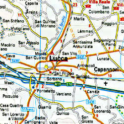
Item Code : REIS9593
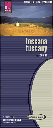 Scale 1:200,000. Reis Know How edition. Very detailed Tuscany road map. English and multi-lingual legends. Printed on tear-resistant, waterproof, paper-like plastic. It can bend and fold without cracking and is writeable as normal paper, non-toxic and recyclable. Perfect for tourist adventures and independent travel and for driving tours. Includes topographic contour lines and hypsometric color tints which show height levels, along with elevation numbers. Shows all major and secondary roads and tertiary roads, with distances between points in kilometers. Fully indexed. Beautiful cartography.
 - $17.95
Item Code : BORC9592
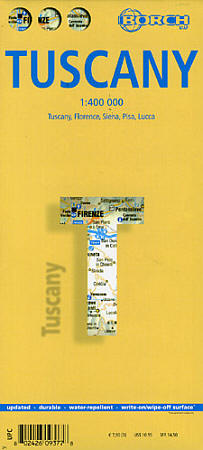
 Scale 1:400,000. Indexed. Borch edition. Laminated, easy-fold, flexi-map.
 -
- $17.95
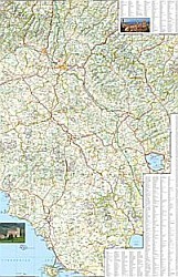
Item Code : ITMB9591
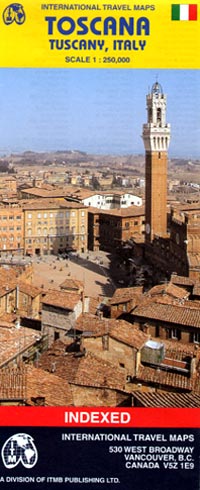
 Scale 1:250,000. Size 38"x38". International Travel Maps edition. Indexed. English text and legends. Elevations and topographic features are shown by hypsometric color tints. Includes considerable useful travel information.
 - $17.95
Item Code : MRCO20913
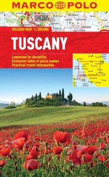 Scale 1:200,000. Marco Polo maps feature completely up-to-date, digitally generated mapping. The high quality cartography with distance indicators and scale converters aid route planning. Contains 4 city maps: Firenze, Livorno, Pisa and Siena. A fold-out overview map is ideal for route planning and 7 self-adhesive Marco Polo mark-it stickers can be used to pin-point a destination or route for future reference. Scenic routes and places of interest are highlighted - ideal for touring holidays. Comprehensive index.
 - $15.95
Item Code : KUMR9590
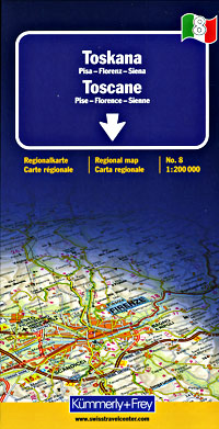
 Scale 1:200,000. Size 36"x54". Kummerly + Frey edition.
 -
- $12.95
Item Code : ROUG9589
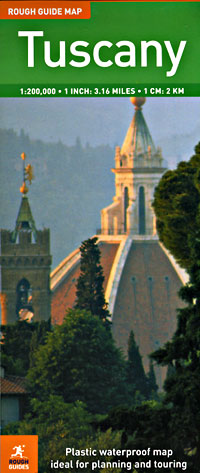
 Scale 1:200,00. Size 28"x40". Rough Guide edition. Printed on tear-resistant, waterproof, lightweight, paper-like plastic. English text and legends. Rugged and convenient.
 -
-
- $17.95
Item Code : MRCO20914
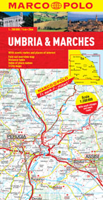 Scale 1:200,000. Marco Polo maps feature completely up-to-date, digitally generated mapping. The high quality cartography with distance indicators and scale converters aid route planning. A fold-out overview map is ideal for route planning and 7 self-adhesive Marco Polo mark-it stickers can be used to pin-point a destination or route for future reference. Scenic routes and places of interest are highlighted - ideal for touring holidays. The maps also contain a comprehensive index and city plans of Ancona, Perugia and Pascara.
 - $19.95
Item Code : REIS9594
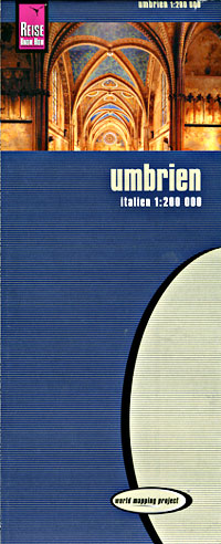
 Scale 1:200,000. Size 28"x40". Reis Know How edition.
 - $18.95
Item Code : TOUR9541
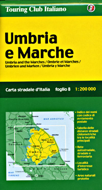
 Umbria and Mache Regions (Perugia-Florence-Ancona).
 -
- $17.95
Item Code : MRCO8892
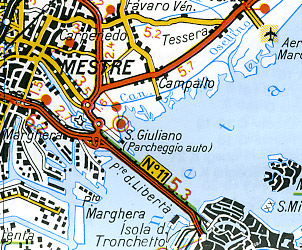
 Scale 1:200,000. This Marco Polo map of Veneto and Friuli features really easy to read cartography. Topography is highlighted with relief shading and loads of spot heights and the road network is clearly shown with roads ranging from motorways all the way through to minor secondary roads. The map also clearly indicates airports, places of interest, scenic/tourist routes, view points etc. The map includes a booklet attached to the cover that contains some useful information and a very extensive index that covers locations, places of interest and geographical features. Also included are a distance/driving time chart and a fold out flap on the cover with an overview map of the region covered. A unique feature of the Marco Polo maps is "mark it" stickers, a set of seven reusable stickers (ie they don't damage the map when removed and placed elsewhere) that can be used to highlight interesting places, the route you plan to take (to make navigation easier), or whatever you want really. The legend is in a multitude of languages including English.
 -
|
Italy Regional Road Maps |
|
TOURING CLUB ITALIANO MAPS |
