
Hungary Road Maps | Detailed Travel Tourist Driving
|
Hungary Road Maps |
Hungary Road Maps
- $14.95
Item Code : HEMA8826
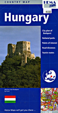
 Scale 1:300,000. Size 40"x38". Indexed. Hema edition. English text legends. Wonderful, large-scale map.
 - $17.95
Item Code : GEOC8827

 Scale 1:300,000. Size 38"x37". Indexed. GeoCenter edition. Printed on both sides. This is a beautiful map. English and multi-lingual legends.
 -
- $17.95
Item Code : ITMB8831
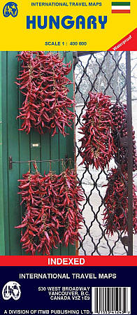
 Scale 1:400,000. Size 39"x27". Indexed. International Travel Maps edition. English text and legends. Elevations and topographic features are shown by hypsometric color tints. Includes considerable useful travel information.
 - $17.95
Item Code : MICH8832
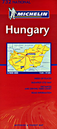
 Scale 1:400,000. Size 39"x57". Michelin edition.
 - $12.95
Item Code : CART8834
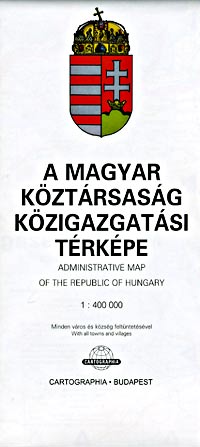
 Scale 1:400,000. Size 33"x52". Cartographia edition.
 - $12.95
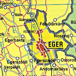
Item Code : CART8833
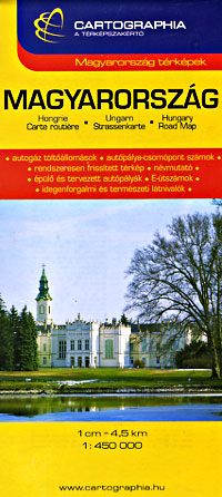
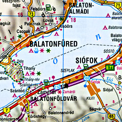 Scale 1:450,000. Size 29"x46". Cartographia edition.
 - $17.95
Item Code : KUMR8835
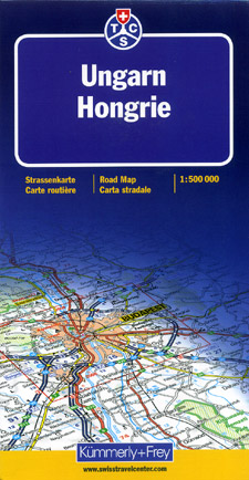
 Scale 1:500,000. Size 27"x40". Kummerly + Frey edition.
 - $19.95
Item Code : REIS8830
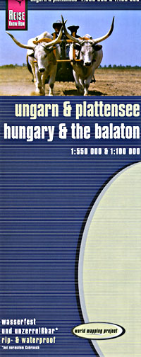
 Scale 1:550,000. Size 27"x39". Reis Know How edition.
 - $13.95
Item Code : HAMD8828
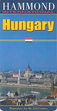
 Scale 1:800,000. Size 39"x42". Hammond International edition. Hungary International Road Map features city insets and contains a comprehensive index.
 - $17.95
Item Code : FREY8829
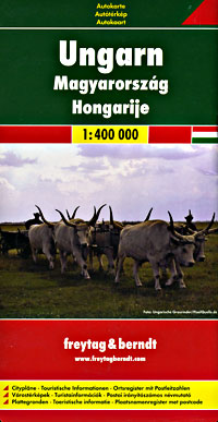 Scale 1:400,000. Size 38"x55" (this is a big map!). Indexed. Freytag & Berndt edition. English and multilingual legends. The entire map is printed on one side for a great view of the country.
 - $64.95 + $8.80 p&h or $22.80 foreign delivery
Item Code : CART8839
 Various Scales. Cartographia edition.
 - $29.95
Item Code : MRCO20568
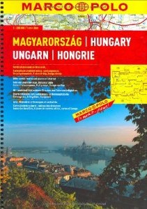 Scale 1:300,000. Size 8”x11½”. Marco Polo edition.
 - $32.95 + $7.50 p&h or $18.80 foreign delivery
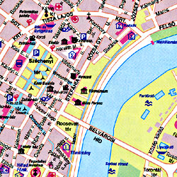
Item Code : CART8836
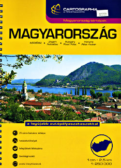
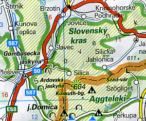
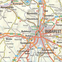
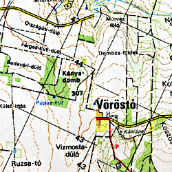
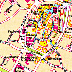 Scale 1:250,000. Size 8"x10?". Fully indexed. 112 pages. Spiral bound. Cartographia edition. Elevation shown by hypsometric color tints. 56 atlas pages. Shows all types of roads and toll roads, road numbers, distances between points in kilometers, gradients, pontoon bridges, railways with stations and stops indicated, railway tunnels, car ferries, passenger ferries, shipping routes, airports, picturesque towns (nice feature) places of particular interest, scenic routes, panoramic view, national parks, nature reserves, castles, palaces, ruins, churches, folk museums, spas, swimming pools, caves, arboretums, lookouts, heights in meters, youth hostels, camping grounds, international borders, border crossings, cities, towns, and villages. Also includes 12 pages of detailed central city street plans of Budapest, Bekescsaba, Debrecen, Eger, Gyor, Miskolc, Szeged, Szekesfehervar, Pecs, Esztergom, Kaposvar, Kecskemet, Nyiregyhaza, Salgotarjan, Sarospatak, Sopron, Szekszard, Szentendre, Szolnok, Szombathely, Tatabanya, Veszprem, Zalaegerszeg. English and Multilingual legends. BIG >> SAMPLE MAP A cartographic 'tour de force'. Laminated card cover. Excellent! << Small sample map
 - $29.95 + $6.80 p&h or $14.80 foreign delivery
Item Code : FREY8837
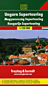
 Scale 1:250,000. Size 6"x10". 157 pages. Fully indexed. Freytag & Berndt edition. Excellent atlas. Similar in scale and information to the one described above, but slightly smaller and more portable, hence more pages.
 - $10.95
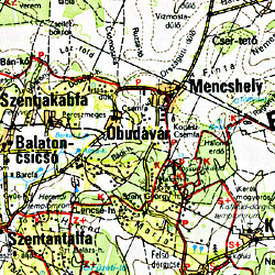
Item Code : CART8840
 Scale 1:40,000. Cartographia edition.
 - $10.95
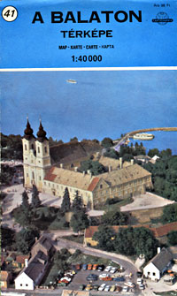
Item Code : CART8841
 Scale 1:40,000. Cartographia edition.
 - $10.95
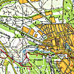
Item Code : CART8842
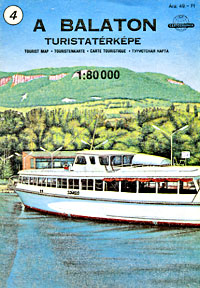
 Scale 1:80,000. Cartographia edition.
 - $10.95
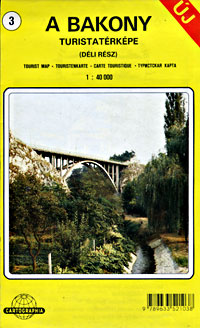
Item Code : CART8843
 Scale 1:40,000. Cartographia edition.
 - $10.95
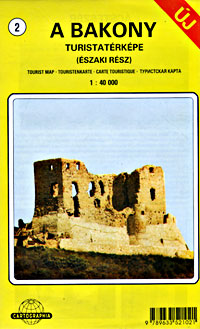
Item Code : CART8844

 Scale 1:40,000. Cartographia edition.
|
Hungary Road Maps |
