
Georgia Road Maps | Detailed Travel Tourist Driving
|
Georgia Road Maps |
Georgia State
- $10.95
Item Code : UNIV8102
 Scale 1:38,000. Size 25"x38". Universal Map edition.
 - $10.95
Item Code : RAND8103
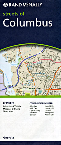
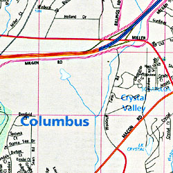 Scale 1:35,000. Size 26"x37". Rand McNally edition.
 - $10.95
Item Code : UNIV8107
 Scale 1:39,000. Size 22"x27". Universal Map edition.
 - $10.95
Item Code : UNIV8108
 Size 23"x35". Universal Map edition.
 - $16.95
Item Code : NATL20976
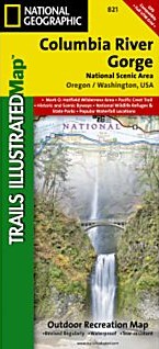
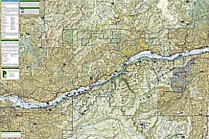 Scale 1:75,000. Size 26"x38". National Geographic edition. This Trails Illustrated topographic map is the most comprehensive recreational map for the Columbia River Gorge areas of Washington and Oregon. The 80 mile long gorge contains diverse ecosystems ranging from the lush Oneonta Gorge Rain Forest to the arid Celilo Grasslands. Areas included on the map: Mark O. Hatfield Wilderness Area; White Salmon, Klickitat, Sandy, and Lower Deschutes Wild and Scenic Rivers; Pacific Crest and Oregon Trails; Mount Hood, Columbia River Gorge, Historic Columbia River Highway, and Yakima Scenic Byways; Hood River County Northwest OHV Area; National Wildlife Refuges; Washington and Oregon State and County Parks, and much more.
 - $249.95 + $24.80 p&h (add $40 for spring rollers)
Item Code : UNIV8092
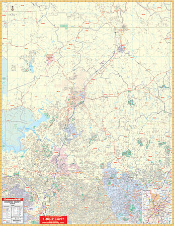 Scale 1:2,000. Size 54" W x 60" H. Laminated. Provides up-to-date cartography with new streets and changes. Printed in color with a markable and washable, laminated surface. Streets are indexed in a separate book. Framing rails are included on top and bottom for easy wall mounting. Railed wall maps can be turned into pull down maps on spring rollers for an additional $40. The area of coverage includes all of Cherokee County with the following boundaries; North: Pickens and Cherokee County line; South: Cobb, Fulton, Cheerokee County lines; East: Forsyth and Cherokee County lines; West: Bartow and Cherokee County lines. Details include airports, cemeteries, hospitals, railroads, post offices, all streets and highways, shopping centers, water features, recreational parks, mileage circles, city limits/annexations, government buildings, fire/police stations, educational facilities, golf/country clubs, ZIP codes/boundaries, longitude/latitude lines, and points of interest.
 - $249.95 + $24.80 p&h (add $40 for spring rollers)
Item Code : UNIV8096
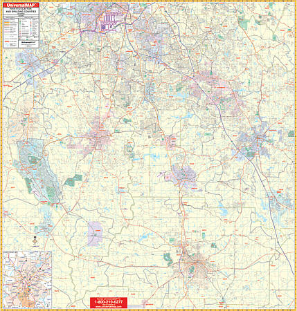 Scale 1:4,224. Size 58" W x 62" H. Laminated. Provides up-to-date cartography with new streets and changes. Printed in color with a markable and washable--laminated surface. Streets are indexed in a separate book. Area of coverage: All of Clayton, Fayette, and Spalding Counties plus a portion of Henry County with the following boundaries: North: Fulton County line to include Hartsfield-Jackson Atlanta International Airport; South: Pike County line to include the town of Griffin; West: Coweta County line to include Peachtree City, Tyrone, and Fairburn in Fulton County plus Senoia in Coweta County; East: to include all of Stockbridge, McDonough, and Locust Grove in Henry County. Map details: all streets and highways, water features, shopping centers, recreational parks, township/section/range lines, government buildings, fire/police stations, educational facilities, golf/country clubs, city limits & annexations, ZIP codes/boundaries, airports, hospitals, railroads, post offices, cemeteries, mileage circles, longitude & latitude lines, block numbers, and points of interest. Comes standard with hanging rails mounted top and bottom. Railed wall maps can be turned into pull down maps on spring rollers for an additional $40.
 - $249.95 + $24.80 p&h (add $40 for spring rollers)
Item Code : UNIV8101
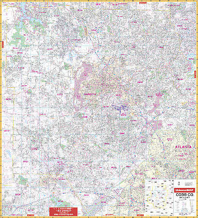 Scale 1:2,000. Size 54" W x 61" H. Laminated. Includes a laminated surface making the wall map markable and washable, along with street indexing in a separate book. The area of coverage includes the following: Cobb County and adjacent area including Austell, Blackwells, Bolton, Clarksdale, Elizabeth, Fair Oaks, East Marietta, Floyd, Kennesaw, Marbleton, Marietta, Noonday, Powder Springs, Smyrna, South Cobb, Vinings, and Westoak; Lithia Springs and portion of Douglasville in Douglas County; approximately 2-4 miles into Atlanta, including I-75 and I-85 in Fulton County; North to the Cherokee County Line; South to the Fulton/Douglas County line; East to the Fulton County line; West to the Paulding County line. Details and information includes: all streets, all highways, educational facilities, post offices, government buildings, fire and police stations, hospitals, shopping centers, land lot numbers, airports, cemeteries, railroads, water features, golf courses and country clubs, mileage circles, recreational parks, ZIP codes and boundaries, city limits and annexations, and other miscellaneous points of interest. Railed wall maps can be turned into pull down maps on spring rollers for an additional $40.
 - $249.95 + $24.80 p&h (add $40 for spring rollers)
Item Code : UNIV8105
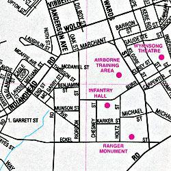
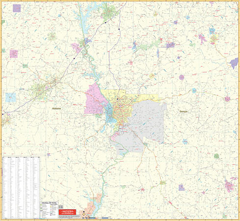
 Scale 1:1,800. Size 60" W x 54" H. Laminated. Provided with up-to-date cartography with new streets and changes. Printed in color with a markable/washable-laminated surface. Streets are indexed on the face of the map. Includes hanging rails mounted top and bottom. Area of coverage: North: to the Muscogee County line; South: includes Lawson Army Field; East: Includes Ft. Benning Military Reservation; West: to include all of Ladonia. Provides a 50 mile radius area map inset. Shows all streets/highways, educational facilities, government buildings, shopping centers, hospitals, ZIP codes/boundaries, post offices, fire/police stations, airports, cemeteries, recreational parks, golf courses/country clubs, city limits and annexations, railroads, mileage circles, water features, and points of interest. Railed wall maps can be turned into pull down maps on spring rollers for an additional $40.
 - $249.95 + $24.80 p&h (add $40 for spring rollers)
Item Code : UNIV8106
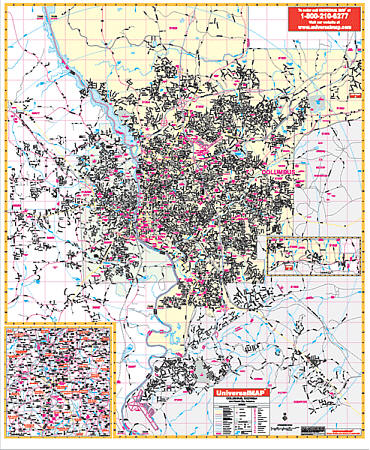
 Scale 1:165,000. Size 58" W x 54" H. Laminated. The 3rd edition Columbus, Georgia Vicinity Wall Map by Universal Map includes portions of surrounding eight counties. Provides full-color with a markable and washable laminated surface. Indexing for cities is on the face of the map. Area of coverage includes the Georgia counties of Chattahoochee, Harris, Marion, Muscosee, Schley, Stewart, Talbot, Webster, and portions of Meriwether, Sumter, Troup, Taylor, and Upson. Alabama counties: Lee, Russell, and portions of Chambers, Macon. Covers: North: 40 miles includes LaGrange; South: 50 miles includes Eufaula and Georgetown; East: 40 miles includes Butler in Taylor County, and Thompson in Upson County; West: 45 miles includes Tuskegee, Notasulga, and Camphill. Details include major streets and all highways, ZIP codes/boundaries, longitude/latitude, county lines/names, airports, parks, mileage circles, and water features. Railed wall maps can be turned into pull down maps on spring rollers for an additional $40.
 - $249.95 + $24.80 p&h (add $40 for spring rollers)
Item Code : UNIV8109
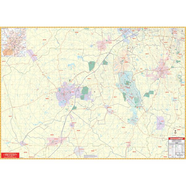 Scale 1:2,640. Size 73" W x 54" H. Laminated. Printed in color with a markable/washable--laminated surface. Street index provided in a separate book. Framing rails are included on top and bottom for easy wall mounting. Railed wall maps can be turned into pull down maps on spring rollers for an additional $40. Area of coverage: All of Coweta and Fayette Counties with the following boundaries: North: to Fulton County line to include Tyrone; Town of Palmetto, and portions of Fairburn in Fulton County; South: Meriwether/Pike County line to include towns of Grantville, Moreland, Haralson in Cowetta County, Brooks in Fayette County, and Luthersville in Meriwether County; East: Clayton County line to include town of Fayetteville; West: to Heard/Carroll County line including Whitesburg in Carroll County. Details include all streets and highways, government buildings, airports, water features, fire/police stations, hospitals, shopping centers, educational facilities, railroads, recreational parks, golf/country clubs, post offices, mileage circles, block numbers, city limits/annexations, cemeteries, longitude & latitude, ZIP codes/boundaries, and points of interest.
 - $25.95
Item Code : NATL20998
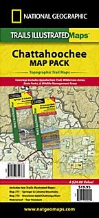 Scale 1:70,000. Size 26"x38". National Geographic edition. Located just north of Atlanta, the Chattahoochee National Forest contains the southern terminus of the Appalachian Trail along with an abundance of recreational opportunities for outdoor enthusiasts of all interests. Save 15% by buying this Chattahoochee Bundle Pack instead of the individual Trails Illustrated Maps for Springer and Cohutta Mountains and Brasstown Bald/Chattooga River. Visit our Springer and Cohutta Mountains or Brasstown Bald/Chattooga River pages to view the maps in detail.
 - $10.95
Item Code : ADCM22713
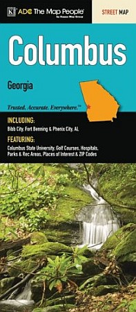 ADC Maps edition. This full-color street map of Columbus, GA includes: Bibb City, Fort Benning, and Phenix City, AL; and features: Columbus State University, Golf Courses, Hospitals, Parks and Rec Areas, Places of Interest, and ZIP Codes.
 - $10.95
Item Code : ADCM22714
 ADC Maps edition. The Conyers and Covington, GA fold map is a full-color, regional map, including street detail insets of: Athens, Madison, McDonough, and Monroe; and features: Airports, Golf Courses, Parks and Rec Areas, Places of Interest, and ZIP Codes.
 -
-
- $10.95
Item Code : UNIV8113
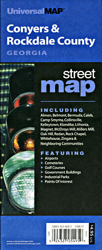
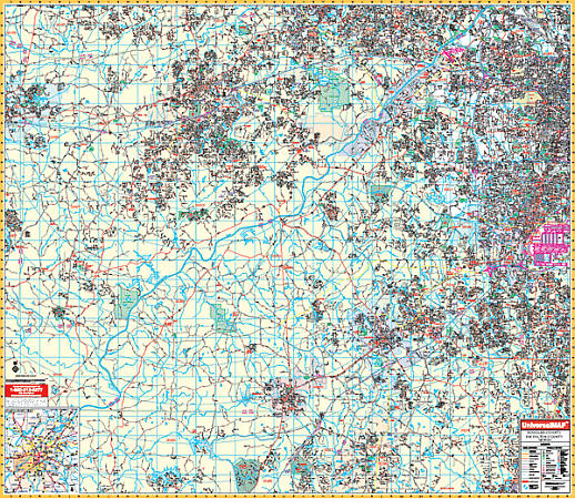
 Scale 1:40,000. Size 27"x39". Universal Map edition.
 - $249.95 + $24.80 p&h (add $40 for spring rollers)
Item Code : UNIV8118
 Scale 1:2,640. Size 60" W x 54" H. Laminated. Provides up-to-date cartography with new streets and changes. Printed in color with a markable and washable--laminated surface. Streets are indexed in a separate book. Area of coverage: All of Douglas County and SW Fulton Counties with the following boundaries: North: Cobb County line including the town of Lithia Springs; South: Coweta County line including portions of Tyrone in Fayette County; East: Hartsfield-Jackson Atlanta International Airport, including College Park and East Point in Fulton County; West: Carroll County line including Villa Rica. Map details: all streets and highways, water features, shopping centers, recreational parks, township/section/range lines, government buildings, fire/police stations, educational facilities, golf/country clubs, city limits & annexations, ZIP codes/boundaries, airports, hospitals, railroads, post offices, cemeteries, mileage circles, longitude & latitude lines, block numbers, and points of interest. Comes standard with hanging rails mounted top and bottom. Railed wall maps can be turned into pull down maps on spring rollers for an additional $40.
 -
-
|
Georgia Road Maps |
