
Colorado Recreation Areas Road Maps | Detailed Travel Tourist Driving
|
Colorado Recreation Areas |
Colorado Recreation Areas
- $17.95
Item Code : TRAL6412
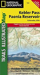
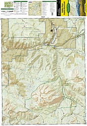 Scale 1:41,000. Size 22"x32". The Kebler Pass/Paonia Reservoir Trails Illustrated map is the most comprehensive recreational map for this beautiful area of Colorado. Coverage includes: Gunnison National Forest; West Elk and Raggeds wilderness areas; Paonia State Recreation Area; the city of Somerset; Beaver Reservoir; Gunnison River; Irwin and Lost lakes; and Gunsight, Minnesota, Ohio, Angel, Castle, and Kebler passes.
 -
- $16.95
Item Code : NATL20941
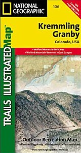
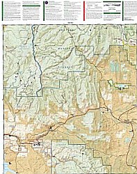 Scale 1:40,680. Size 22"x32". National Geographic edition. The most comprehensive recreational map for: Arapaho National Forest; Arapaho National Recreation Area; the cities of Kremmling, Granby, Hot Sulphur Springs and Parshall; a popular segment of the Colorado River; Willow Creek, Windy Gap, Hinman and Williams Fork reservoirs; Antelope, Cottonwood and Gunsight passes; and the Silver Creek ski area.
 - $17.95
Item Code : TRAL6414
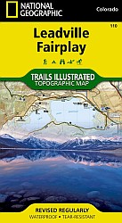
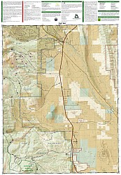 Scale 1:41,000. Size 22"x32". Coverage includes the Pike and San Isabel national forests, Buffalo Peaks Wilderness Area, and the cities of Fairplay, Leadville, Malta, and Granite. Also included are the Twin Lakes and Clear Creek reservoirs, Mt Massive Lakes, a segment of the Arkansas River, and Breakneck, Weston and Browns passes. 14ers: Mt Sherman. Portions of the Continental Divide Trail and Colorado Trail are covered on this map. Includes UTM grids for use with your GPS unit, and CO Game Management Unit (GMU) boundaries.
 - $17.95
Item Code : TRAL6415
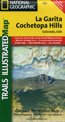
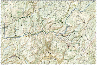 Scale 1:63,000. Size 25"x37". The La Garita/Cochetopa Hills Trails Illustrated map is the most comprehensive recreational map for this tucked away corner of Colorado. Coverage includes: San Isabel, Gunnison and Rio Grande National Forests; La Garita Wilderness; Cochetopa Hills; Cebolla Creek State Wildlife Area; Dome Lakes State Wildlife Area; O'Haver Lake; Vouga Reservoir; Devils Lake; Saguache Creek; Black Mountain Lake; cities of Creede, Cathedral, Monchego Park; 14ers: San Luis Peak, Monarch, Slumgullion, Cochetopa, Marshall, Halfmoon and San Luis passes; Jon Wilson Yurt and Rambouillet Yurt; Portions of Continental Divide Trail and Colorado Trail.
 - $17.95
Item Code : TRAL6416
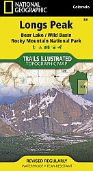
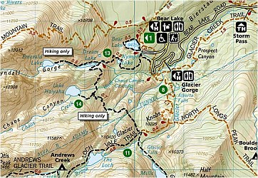
 Scale 1:25,000. Size 22"x32". This Trails Illustrated topographic map is the most comprehensive recreational map for the Longs Peak, Bear Lake, and Wild Basin areas of Rocky Mountain National Park in Colorado. The map's shaded relief makes it easy to see the lay-of-the-land, and it has a full UTM grid so you can use it with your GPS.
 - $17.95
Item Code : TRAL6417

 Scale 1:41,000. Size 22"x38". The Maroon Bells/Redstone/Marble Trails Illustrated map is the most comprehensive recreational map for this popular area in the heart of the mountains of Colorado. Coverage includes: White River and Gunnison National Forests; Raggeds and Maroon Bells-Snowmass wilderness areas; the cities of Redstone, Marble, Placita and Woody Creeks; Crystal and Roaring Fork rivers; and Snowmass Lake; Snowmass ski area; 14ers: Snowmass Mountain, Pyramid, North Maroon, Maroon and Capitol peaks, as well as Schofield, McClure, Anthracite, Buckskin East and West Maroon passes.
 - $17.95
Item Code : TRAL6419

 Scale 1:63,000. Size 25"x37". The Pikes Peak/Canon City Trails Illustrated map is the most comprehensive recreational map for this popular 14er and surrounding area west of Colorado Springs. Coverage includes: Pike National Forest; Beaver Creek and McIntyre Hills Wilderness Study Area; Mueller State Park; Florissant Fossil Beds National Monument; Red Canyon and Royal Gorge Parks; cities of Colorado Springs, Woodland Park, Manitou Springs, Lake George, Tarryall, Parkdale, Canon City, Victor, Cripple Creek and Gillette; Elevenmile, North Slope, Skagway and Rampart reservoirs; Arkansas River; Fountain Creek and Beaver Creek; and the U.S. Air Force Academy. 14ers: Pikes Peak. This revised map is updated with new shaded relief and contours. The trails have been enhanced and road and trail mileage have been added to create a more usable map. UTM grids have been added to make it more usable with your GPS.
 - $17.95
Item Code : TRAL22622
 Scale 1:50,000. Trails Illustrated map edition.
 - $16.95
Item Code : NATL20958
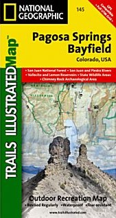
 Scale 1:63,360. Size 26"x38". National Geographic edition. Completed with the assistance of the San Juan Public Lands Center, this map includes: San Juan National Forest; San Juan & Piedra Rivers; Vallecito & Lemon Reservoir; Chimney Rock Archaeological Area; Piedra Natural Area; Navajo State Park; State Wildlife Areas; and the towns of Pagosa Springs and Bayfield. Its coverage overlaps with these other Trails Illustrated maps: TI 144 Durango-Cortez, TI 142 South San Juan-Del Norte, and TI 140 Weminuche.
 - $17.95
Item Code : TRAL6420
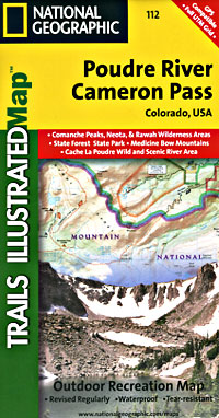
 Scale 1:41,000. Size 22"x32". The Poudre River/Cameron Pass Trails Illustrated map is the most comprehensive recreational map for this beautiful area surrounding the northern portion of Rocky Mountain National Park in Colorado. Coverage includes: Arapaho and Roosevelt national forests; Pingree Park; the Rawah; Commanche Peak; Neota wilderness areas; Cameron, Montgomery and Grassy passes; the Colorado State Forest; the cities of Indian Meadows, Spencer Heights and Glen Echo; Chambers Lake; Cache La Poudre and Laramie rivers; Comanche and Joe Wright reservoirs.
 - $17.95
Item Code : TRAL6421
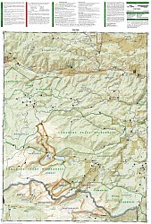
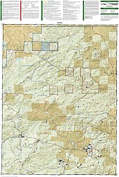
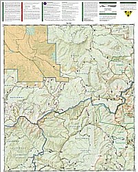
 Scale 1:41,000. Size 26"x32". Coverage includes the Routt and Arapaho national forests, Never Summer Wilderness, Rabbit Ears Range, and the cities of Spicer and Rand. Also included are Seymour and Arapaho lakes, the Illinois River, and the following mountain passes: Calamity, Grannys Nipple, Indian, Bowen, Illinois and Willow Creek. Includes UTM grids for use with your GPS unit.
 - $17.95
Item Code : TRAL6422
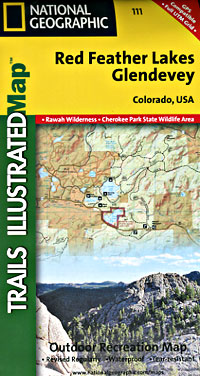
 Scale 1:41,000. Size 22"x32". Coverage includes the Arapaho and Roosevelt national forests, Rawah Wilderness, Four Corners, Glendevey. Laramie River, Red Feather Lakes and Eaton Reservoir. Also included are the Sand Creek, Horse Ranch and Red Mountain passes. Includes UTM grids for use with your GPS unit.
 - $16.95
Item Code : NATL20943
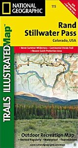
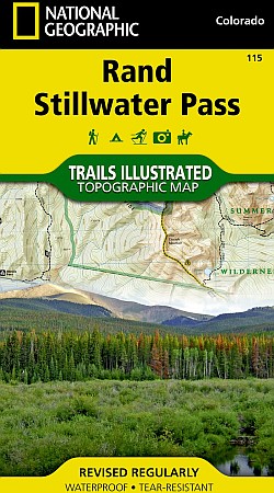
 Scale 1:40,680. Size 25½"x32". National Geographic edition. The Rand/Stillwater Pass Trails Illustrated map is the most comprehensive and complete recreational map for this beautiful area in northern Colorado. Coverage includes the Routt and Arapaho national forests, Never Summer Wilderness, Rabbit Ears Range, and the cities of Spicer and Rand. Also included are Seymour and Arapaho lakes, the Illinois River, and the following mountain passes: Calamity, Grannys Nipple, Indian, Bowen, Illinois and Willow Creek.
 - $22.95
Item Code : NATL6424
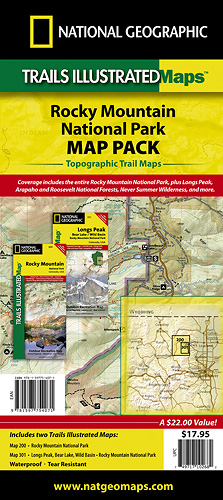 Scale 1:25,000 & 1:50,000. Size 26"x38". National Geographic edition. Includes both our Rocky Mountain National Park and Longs Peak Trails Illustrated maps, providing you coverage of the entire map region, while saving you over 15%. Like all Trails Illustrated maps, the Rocky Mountain National Park Bundle set is frequently revised and printed on waterproof, tear-resistant material to stand up to all conditions. This detailed topographic recreation map bundle contains carefully researched trails, campsites, forest service roads, and points-of-interests. Includes UTM grids for use with your GPS unit. Each map size is 26 x 38 inches unfolded.
 - $17.95
Item Code : TRAL6425
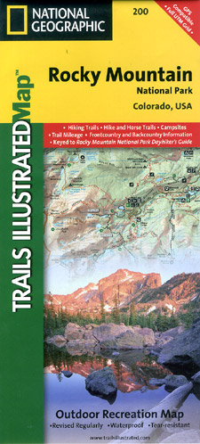
 Scale 1:50,000. Size 26"x35". Trails Illustrated edition. Printed on waterproof, tear-resistant, lightweight, paper-like plastic. The Rocky Mountain National Park Trails Illustrated map is the most comprehensive recreational map for Colorado's Rocky Mountain National Park. Coverage includes Rocky Mountain National Park, Arapaho and Roosevelt National Forest, Never Summer Wilderness, Arapaho National Recreation Area, and the cities of Granby and Estes Park. Revisions to this map provide easy-to-read trail mileage and markers, hiking-only and hike and horse trails are easily distinguished, Federal, State and Private lands are clearly marked, the Continental Divide Trail is highlighted, and the map is keyed to the updated Rocky Mountain National Park Dayhiker's Guide. The map's shaded relief makes it easy to see the lay-of-the-land, and it has a full UTM grid so you can use it with your GPS.
 - $12.95
Item Code : SKYT6426
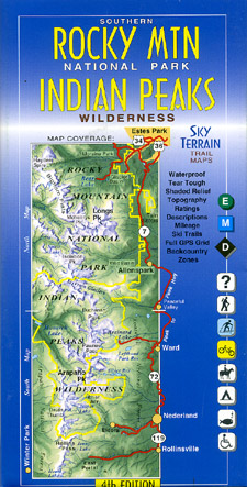
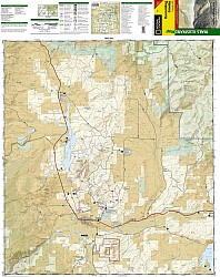
 Scale 1:40,000. Size 24"x36". Sky Terrain edition. This area is beautiful and popular. Within an hour or two you can escape the urban bustle of the Front Range and arrive in an alpine world with plenty of hiking, camping and skiing.
 - $17.95
Item Code : TRAL6428
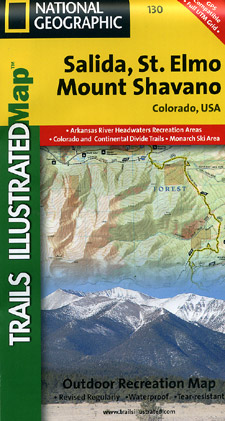
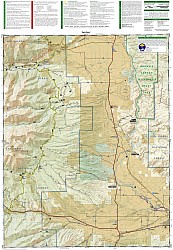 Elmo, and Mt. Shavano Area. Scale 1:41,000. Size 22"x32". Coverage includes San Isabel and Gunnison national forests; the cities of Garfield, Romley, St Elmo, Poncha Springs, Mt Princeton Hot Springs, and Hancock; the Arkansas River; Pomeroy, Hancock and Waterdog lakes. 14ers: Mt Princeton, Antero and Shavano. Ski Areas: Monarch. Includes UTM grids for use with your GPS unit.
 - $10.95
Item Code : RFUS22620
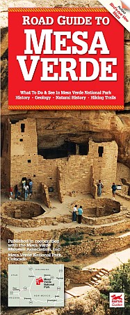
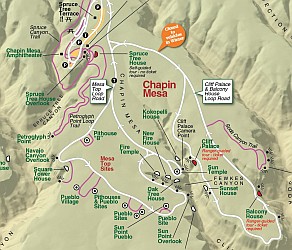 Rufus Graphics edition. This comprehensive 21-page guide provides an overview of the park's extraordinary cliff dwellings that were inhabited by the Ancestral Puebloans of Mesa Verde until about A.D. 1300. Photographs and tour information are provided for all park destinations. Scenic overlooks and five hiking trails are described, as are the park's history, animals, plants, geology and wildfire. Detailed fold-out maps, key phone numbers, and at-a-glance visitor services are included. Booklet with foldout map.
 - $17.95
Item Code : TRAL6429
Scale 1:75,000. Size 25"x37". The Sangre de Cristo Mountains Trails Illustrated map is the most comprehensive and complete recreational map for this popular wilderness area in south central Colorado. Coverage includes Sangre de Cristo Mountains; Great Sand Dunes National Park and Preserve; San Isabel and Rio Grande national forests; Sangre de Cristo Wilderness; Arkansas Headwaters Recreation Area; San Luis State Park; San Luis Lakes; DeWeese Reservoir and Huerfano State Wildlife Areas; Blanca Wetlands; Rainbow Trail; Hayden, Medano and Mosca passes. 14ers: Blanca Peak, Crestone Peak, Crestone Needle, Kit Carson Mt, Challenger Point, Humboldt Peak, Ellingwood Point, Little Bear Peak and Mount Lindsey.

|
Colorado Recreation Areas |
