
Canada Road Maps | Detailed Folded Travel Tourist Driving Maps
CANADA – EXPLORE THE COUNTRY WITH US
Canada is situated in the continent of North America. Canada is the world’s second largest country by total area and it is the fourth largest country by the land area. It has three states and three territories which are being extended from the Atlantic to pacific and towards the north in the Arctic Ocean. The country’s capital is Ottawa and its one-third population resides in Toronto, Montreal, and Vancouver, the three largest cities in Canada.
According to the census, Canada has a total population of 35 crore. As of the population, Canada is one of the most educated countries as the government invests a bulk amount of money for the education. Because of government’s investment in education, more than half of the population has attained at least under graduate college degree.
As of the language, Canadians mostly use English and French. But due to the migration of people from all over the world, there are many languages spoken in Canada like Chinese, Punjabi, Spanish, German, Punjabi and Italian. As there are many languages spoken, but in courts, language for instruction and for other government services French is the official language in addition to English.
Canada is also known for its culture, historic sites and many natural parks, because of this, it attracts many tourists. In 2012, around 15 million tourists arrived in Canada adding US $17 billion to the economy and support more than 400,000 jobs in the country. Talking about tourism, heritages are one of the most popular tourist attractions. There are total 17 World Heritage sites in which 8 of them are Cultural heritages and 9 are Natural Heritages.
Vancouver, one of the largest city, attracts a lot of tourist for sight seeing. Capilano Suspension Bridge, Butchart Gardens, Gastown attracts large tourists. Similarly, other states like Alberta is known for its rocky mountains, Manitoba is known for rivers and lakes and Ontario is known for camping destinations. As most of the tourists are attracted towards beaches, New Brunswick is the best place for beaches.
Canada is a great country to visit and has a great culture that is worth exploring and our maps will help you through it.
Canada Road Maps for Tourists and TravelersDetailed Road Map of CanadaBuy travel maps for Canada tourist attractions, road trips, street guide, driving directions and more |
Canada
- $34.95 Rolled + $8.80 p&h or $28.80 foreign delivery
Item Code : UNIV6115
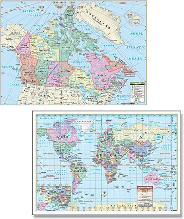 Universal Map edition. 28"x37". Laminated. Canada Rolled Laminated Maps feature capitals and provincial boundaries. The World Rolled Map displays the Mercator projection and offers complete coverage, including an inset of Europe. Rolled Maps of Canada and the World are the perfect compliment for students of all ages.
 - $17.95 Rolled + $6.80 p&h or $28.80 foreign delivery
Item Code : NATL6116
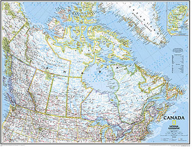
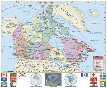
 Scale 1:6,400,000. Size 32"x38". National Geographic edition. Flat. Our most detailed wall map of Canada, features the classic National Geographic reference styling. Features thousands of place names, accurate political boundaries, national parks, archeological sites, and major infrastructure networks such as roads, canals, ferry routes, and railroads. Canada's diverse terrain is detailed through accurate shaded relief, coastal bathymetry, and symbolism for water features and other landforms. This wall map depicts Canada and the areas surrounding the Great Lakes. Includes Canadian provinces and US State boundaries.
 - $24.95 Rolled + $8.80 p&h or $36.80 foreign delivery
Item Code : NATL6117
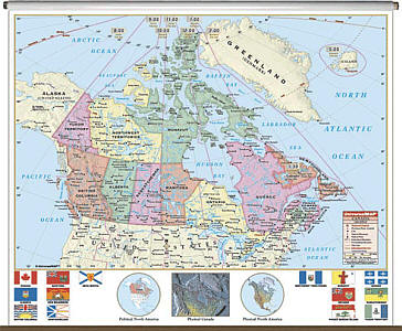
 Scale 1:6,400,000. Size 32"x38". National Geographic edition. Tubed. Our most detailed wall map of Canada, features the classic National Geographic reference styling. Features thousands of place names, accurate political boundaries, national parks, archeological sites, and major infrastructure networks such as roads, canals, ferry routes, and railroads. Canada's diverse terrain is detailed through accurate shaded relief, coastal bathymetry, and symbolism for water features and other landforms. This wall map depicts Canada and the areas surrounding the Great Lakes. Includes Canadian provinces and US State boundaries.
 - $34.95 Rolled + $12.80 p&h or $38.80 foreign delivery
Item Code : NATL6118
 Scale 1:6,400,000. Size 32"x38". National Geographic edition. Laminated. Our most detailed wall map of Canada, features the classic National Geographic reference styling. Features thousands of place names, accurate political boundaries, national parks, archeological sites, and major infrastructure networks such as roads, canals, ferry routes, and railroads. Canada's diverse terrain is detailed through accurate shaded relief, coastal bathymetry, and symbolism for water features and other landforms. This wall map depicts Canada and the areas surrounding the Great Lakes. Includes Canadian provinces and US State boundaries.
 - $269.95 Rolled + $24.80 p&h
Item Code : UNIV6122
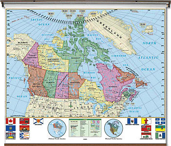
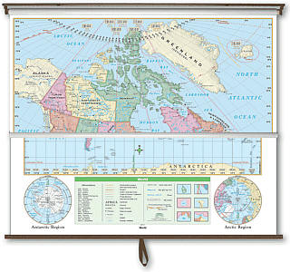 Size 54"x64". Universal Map edition. Laminated. The Canada/World Essential Combo Classroom Wall Map illustrates the 13 provinces and their flags, plus parts of surrounding countries. Measures 64" x 54". The Essential Series mounted on roller with backboard. features the same clear concise maps as the primary series, but with an enhanced legend and pictorial landform illustrations for intermediate level use. Also shows deserts and wetlands. The inset map locator illustrates the location of each continent in the world. Appropriate for grades 4 through 8. This product is ideal for public, private, parochial, and home schools.
 - $269.95 Rolled + $24.80 p&h
Item Code : UNIV6123
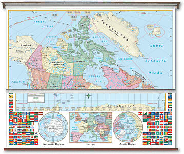 Size 54"x64". Universal Map edition. Laminated. This is one of the most essential maps for classroom and business use. The Canada/World Primary Combo Classroom Wall Map from Universal Map features updated, full-color cartography with political boundaries, capitals, major cities and more. Special features include country flags as well as insets of Europe and the poles. This product is ideal for public, private, parochial, and home schools. Mounted on rails with backboard. Measures 64" x 54".
 - $179.95 Rolled + $24.80 p&h
Item Code : UNIV6124
 Size 54"x64". Universal Map edition. Laminated. The Canada Essential Classroom Wall Map illustrates the 13 provinces and their flags, plus parts of surrounding countries. Measures 64" x 54". Mounted on Roller with Backboard. The Essential Series features an enhanced legend and pictorial landform illustrations for intermediate level use. Also shows deserts & wetlands. The inset map locator illustrates the location of each continent in the world. Appropriate for grades 4 - 8. This product is ideal for public, private, parochial, and home schools.
 - $139.95 Rolled + $24.80 p&h
Item Code : UNIV6125
 Size 54"x64". Universal Map edition. Laminated. The Canada Classroom Wall Map by Universal Map features province flags and North America inset maps. Measures 64" by 54". Multi-colored classroom wall maps help students identify political boundaries and national capitals. Physical landforms are shown in shaded relief. Classroom wall maps have laminated surfaces, which are markable and washable, and are mounted on framing rails. This product is ideal for public, private, parochial, and home schools.
 - $179.95 Rolled + $24.80 p&h
Item Code : UNIV6126
 Size 54"x64". Universal Map edition. Laminated. The Canada Primary Wall Map features province flags and North America inset maps. Measures 64" w x 54" h. Multi-colored classroom wall maps help students identify political boundaries and national capitals. Physical landforms are shown in shaded relief. Classroom wall maps have a markable, washable-laminated surface, and are mounted on roller with backboard. This product is ideal for public, private, parochial, and home schools.
 - $17.95
Item Code : MRCO20867
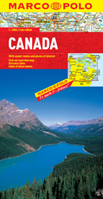 Scale 1:4,000,000. Marco Polo maps feature completely up-to-date, digitally generated mapping. The high quality cartography with distance indicators and scale converters aid route planning. A fold-out overview map is ideal for route planning and 7 self-adhesive Marco Polo mark-it stickers can be used to pin-point a destination or route for future reference. Scenic routes and places of interest are highlighted - ideal for touring holidays. Comprehensive index.
 - $10.95
Item Code : ROUT21243
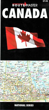 Scale 1:8,625,000. Route Master edition. A very detailed map of Canada. On one side, you have a map of Canada, and on the other side more details maps of Vancouver, Edmonton, Saskatoon, Winniped, Victoria, Calgary, Regina, Montreal, Toronto, Ottawa and Charlottetown.
 - $17.95 Rolled + $6.80 p&h or $28.80 foreign delivery
Item Code : NATL6119
Scale 1:6,400,000. Size 32"x38". National Geographic edition. Flat. - $24.95 Rolled + $8.80 p&h or $36.80 foreign delivery
Item Code : NATL6120
Scale 1:6,400,000. Size 32"x38". National Geographic edition. Tubed. - $34.95 Rolled + $12.80 p&h or $38.80 foreign delivery
Item Code : NATL6121
Scale 1:6,400,000. Size 32"x38". National Geographic edition. Laminated. - $49.95 Rolled + $12.80 p&h or $38.80 foreign delivery
Item Code : ITMB6127
Scale 1:300,000. International Travel Maps edition. - $69.95 Rolled + $12.80 p&h or $38.80 foreign delivery
Item Code : ITMB6128
Scale 1:300,000. International Travel Maps edition. Laminated. - $12.95
Item Code : MART21290
MapArt. Laminated road map covering all of Canada. Longlasting, ideal for wet or muddy conditions. - $17.95
Item Code : ITMB1016
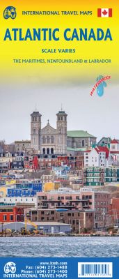
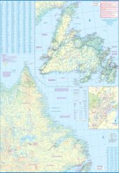
Size 27"x39". International Travel Maps edition.
2nd Edition- Scale varies - On waterproof paper The first edition was published in 2000 using artwork under licence. This edition uses original ITMB artwork. Side 1 cover Nova Scotia, New Brunswick, and Price Edward Island as well as Quebec's Magdalen Islands at a scale of 1:800,000. This side also includes the Top 10 Attractions of the three provinces.
The second side is devoted to the Canadian Province of Newfoundland and Labrador, with the much smaller island portion being a half-page inset at 1:150,000 scale and the larger mainland portion being at 1:1,700,000. The northernmost tip of Quebec/Labrador belongs to Nunavut. St.Pierre et Miquelon, a French overseas possession just south of Newfoundland Island, is also included, as well as the map's only urban inset, historic St.John's, one of North America's oldest cities.
The map also includes a listing of 9 Top Attractions. ITMB also publishes maps of the individual provinces, but the advantages of this regional map is that it combines together four interesting parts of Canada on to one sheet, ideal for someone making a grand circle trip. It is printed on durable, waterproof, decomposable stone paper.
-
-
| Postage and handling is $3.50 for the first map and $1.50 for each additional map. ~ ~ ~ ~ ~ ~ Foreign delivery is $7.80 for the first map and $5.00 for each additional map. |
| ** Click here! to view our beautiful collection of Canada Travel VIDEOS ** |
| ** Click here! to view our French Canadian Language Courses ** |
CANADA – EXPLORE THE COUNTRY WITH US
Canada is situated in the continent of North America. Canada is the world’s second largest country by total area and it is the fourth largest country by the land area. It has three states and three territories which are being extended from the Atlantic to pacific and towards the north in the Arctic Ocean. The country’s capital is Ottawa and its one-third population resides in Toronto, Montreal, and Vancouver, the three largest cities in Canada.
According to the census, Canada has a total population of 35 crore. As of the population, Canada is one of the most educated countries as the government invests a bulk amount of money for the education. Because of government’s investment in education, more than half of the population has attained at least under graduate college degree.
As of the language, Canadians mostly use English and French. But due to the migration of people from all over the world, there are many languages spoken in Canada like Chinese, Punjabi, Spanish, German, Punjabi and Italian. As there are many languages spoken, but in courts, language for instruction and for other government services French is the official language in addition to English.
Canada is also known for its culture, historic sites and many natural parks, because of this, it attracts many tourists. In 2012, around 15 million tourists arrived in Canada adding US $17 billion to the economy and support more than 400,000 jobs in the country. Talking about tourism, heritages are one of the most popular tourist attractions. There are total 17 World Heritage sites in which 8 of them are Cultural heritages and 9 are Natural Heritages.
Vancouver, one of the largest city, attracts a lot of tourist for sight seeing. Capilano Suspension Bridge, Butchart Gardens, Gastown attracts large tourists. Similarly, other states like Alberta is known for its rocky mountains, Manitoba is known for rivers and lakes and Ontario is known for camping destinations. As most of the tourists are attracted towards beaches, New Brunswick is the best place for beaches.
Canada is a great country to visit and has a great culture that is worth exploring and our maps will help you through it.
Canada Road Maps for Tourists and TravelersDetailed Road Map of CanadaBuy travel maps for Canada tourist attractions, road trips, street guide, driving directions and more |
