
California Road Maps | Detailed Travel Tourist Driving
Rediscover California with all new California Road Maps
California is the most populous state of the U.S and third largest in area. It is a destination worth visiting for everyone.
Whether you are geeky or adventurous, California has at least one must-visit place for you. California is a state with hot deserts, beautiful hills as well as mesmerizing beaches. Experience the marvels of nature by taking a road trip to California.
There is Disneyland to fulfil your childhood wish of meeting your favorite characters. The movie buffs should definitely pay a visit to Hollywood. For the fans of Baywatch and the lovers of nature, Malibu beaches are your go to place.
Live the history of California by visiting the Golden Gate Bridge. Don’t forget the hills of San Francisco. Do pay a visit to California State Rail Road Museum. It is the largest museum of its kind in the whole of North America. If you love wine, visiting Napa Valley should be on the top of your to-do list. To satiate your adventurous nature, visit Tahoe Lake for amazing water sports and skiing. And who can forget the Silicon Valley, the house of all tech giants and a dream job location for many.
California houses plenty of national parks and state parks too. California offers natural beauty, adventure sports, historical places, everything in one state. There are so many places to visit in California. A trip to California is a must for everyone.
So what say! Fancy a road trip to California? Use this incredible all new California Road map. It maps all the must-watch destinations as well as some lesser known destinations. The map is created using modern technology and the results given are accurate.
What’s the wait then? Let’s pack our bags and rediscover California like never before.
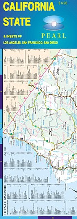
California Road Maps for Tourists and TravelersDetailed Road Map of CaliforniaBuy travel maps for California tourist attractions, road trips, street guide, driving directions and more |
| What you’ll find in this section, all arranged in the following order: a. California States Maps and Atlases (see below) b. Recreation and Special Interest Tourist Maps of California Click Here c. California County Road Maps and Atlases Click Here d. City Street Plans and Atlases of California ~ A to L Click Here e. City Street Plans and Atlases of California ~ M to San Diego Click Here f. City Street Plans and Atlases of California ~ San Francisco to Z Click Here Please look down the list and find the map or atlas of your choice! |
California Road Maps
- $29.95 + $7.50 p&h or $28.50 foreign delivery
Item Code : DELR6062
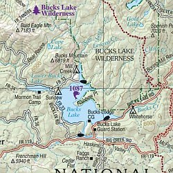 Scale 1:150,000. Full size, 11"x15?". 160 pages. DeLorme edition. Designed for those who want to get off the beaten path, this atlas shows all types of roads and tracks, cities, towns, hamlets, and provides topographic maps that show hiking trails, campgrounds, fishing spots, ski areas, and more. Contains a guide to state and national parks and recreation areas, historic sites, and unique natural areas. Comprehensive index enables the user to find locations quickly and easily. Great for car or backpack! Saddle-stitched, durable laminated paper cover.
 - $29.95 + $7.50 p&h or $28.80 foreign delivery
Item Code : BENC6063

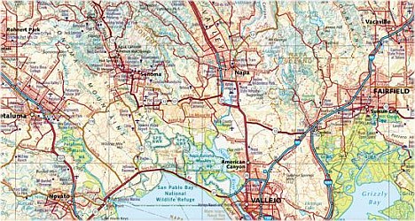 Scale 1:300,000. Size 10?"x15". 144 pages. Indexed. Benchmark Maps edition. California is a land of startling contrasts. Explore the geographical diversity and natural beauty and get to know the best of California with this marvelous atlas. The latest edition has freeway exit numbers and the Landscape MapsTM are clearer, brighter and easier to read. The comprehensive Recreation Guide and accompanying maps are the perfect resource to plan the ultimate California adventure. Data included in this California Road and Recreation Atlas: Landscape Maps, Field-check road information, Recreation Guide, Campgrounds, Boating ramps, RV parks, Ski Areas, Fishing and hunting information, Climate data, Museums, Natural Wonders Coverage Area: California with metro maps of Los Angeles, San Francisco, San Diego and Sacramento and special recreation map of Lake Tahoe Insets: 16 pages of metro maps, Lake Tahoe map and three urban recreation maps
 -
- $10.95
Item Code : GBLG22500
 Global Graphics. Highway map features Interstate, U.S highways, State highways, relief-shading, index of cities/towns, inset maps of Los Angeles, San Francisco and San Diego.
 - $259.00 Shipped rolled in a tube + $24.80 p&h + $36.80 foreign delivery
Item Code : RAND6066
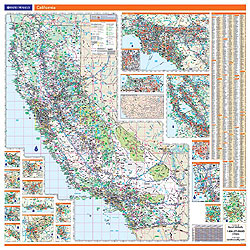
 Scale 1:843,000. Size 46"x60". Laminated. Professional Grade. Rand McNally's ProSeries wall map of California is ideal for anyone needing a comprehensive representation of the state for planning, routing, or reference. It's a great choice for business and sales strategy, urban development, social work outreach, education, and marketing. ?Durable lamination for writing on and wiping off ?UV-resistant ink to help prevent color fading ?City/county index on the map ?Inset maps of major cities (see "coverage area" tab) ?Mileage chart and driving times map between the state's main cities ?Hanging kit with rails for easy mounting just about anywhere ?Ideal for business, education, planning, or reference planning Map indications include: ?State, federal, and county highways ?County boundaries ?Cities and towns ?Major waterways ?State and national parks ?Campsites ?Rest areas ?Military installations ?Airports ?Golf courses ?Universities Coverage area: California and portions of surrounding states. Inset maps: Bakersfield; Fresno; Los Angeles; Downtown Los Angeles; Modesto; Monterey/Salinas; Oceanside; Palm Springs; Sacramento; San Diego; Downtown San Diego.
 - $17.95
Item Code : BORC22507
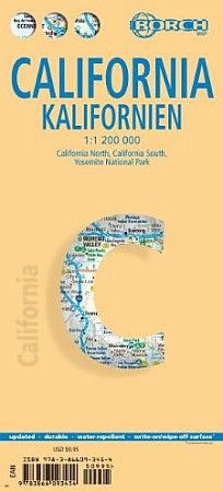
 Borch edition California North 1:1 200 000, California South 1:1 200 000, Yosemite National Park 1:675 000, USA administrative and time zones. Borch Maps are easy to fold, durable and water-repellent with a wipeable surface. Borch Maps show hotels, museums, monuments, markets, public transport, top sights and points of interest, useful statistics, conversion charts for temperatures, weights and measurements, climate charts showing temperatures, sunshine hours, precipitation and humidity, overview maps, time zones, and much more...
 - $10.95
Item Code : BELA22512
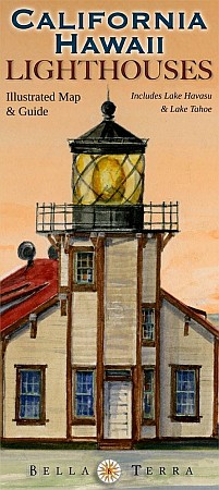
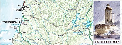 Scale 1:1,550,000. Size 24"x36". Bella Terra Maps edition. Detailed shaded relief maps Insets for Bay Area, Lake Tahoe & Lake Havasu (including Arizona) Locations of all standing & "lost" lighthouses. 31 specially commissioned watercolor illustrations History & description of each lighthouse Detailed directions to view each standing light Locations & directory of lighthouse & maritime museums Directory of lighthouse cruises, ferries & sightseeing flights True Tales of California & Hawaii lighthouses.
 - $14.95
Item Code : GMJO22506
 G.M. Johnson edition. Laminated road map of California showing the major highways throughout the state. Ideal for long road trips.
 - $10.95
Item Code : RAND22510
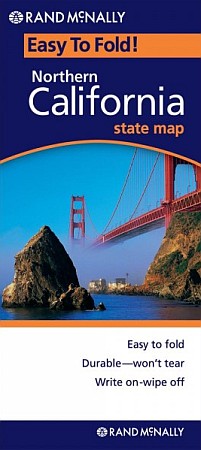 Rand McNally edition. The durable and convenient Northern California EasyToFold state map will take all the wear and tear your journey can dish out. The heavy-duty laminated design allows you to mark your route, make notes, then wipe the surface clean for further use. This is a must-have for navigation whether you're a state resident or just passing through.
 - $10.95
Item Code : RAND22511
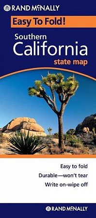 Rand McNally edition. The durable and convenient Southern California EasyToFold state map will take all the wear and tear your journey can dish out. The heavy-duty laminated design allows you to mark your route, make notes, then wipe the surface clean for further use. This is a must-have for navigation whether you're a state resident or just passing through.
 - $17.95
Item Code : ITMB6058
International Travel Maps edition. - $14.95
Item Code : BELA22513
Scale 1:1,550,000. Size 24"x36". Bella Terra Maps edition. Detailed shaded relief maps Insets for Bay Area, Lake Tahoe & Lake Havasu (including Arizona) Locations of all standing & "lost" lighthouses 31 specially commissioned watercolor illustrations History & description of each lighthouse Detailed directions to view each standing light Locations & directory of lighthouse & maritime museums Directory of lighthouse cruises, ferries & sightseeing flights True Tales of California & Hawaii lighthouses. - $249.95 + $24.80 p&h (add $40 for spring rollers)
Item Code : UNIV6065
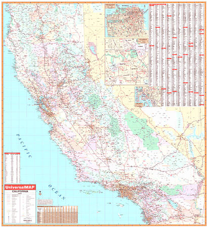 Scale 1:11,00,000. Size 54" W x 60" H. Laminated. The California Wall Map by Universal Map is laminated, indexed on the face of the map. Details all state/federal highways, cities, towns, major waterways, airports, hospitals, wildlife areas, state universities, state and national parks, military reservations, a mileage chart between major cities, county names/boundaries, color coded boundaries, and points of interest. Framing rails are included on top and bottom for easy wall mounting. Railed wall maps can be turned into pull down maps on spring rollers for an additional $40.
 - $249.95 + $24.80 p&h (add $40 for spring rollers)
Item Code : UNIV6067
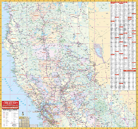
 Scale 1:110,750. Size 52" W x 60" H. Laminated. Printed in color with a markable/washable-laminated surface. Counties are indexed on the face of the map. Includes all state and federal highways, secondary roads, cities and towns, major airports, major waterways, military installations, and state/national parks. Detailed insets of the following major cities and areas: Los Angeles/Orange San Diego San Francisco Sacramento. Railed wall maps can be turned into pull down maps on spring rollers for an additional $40.
 - $259.95 + $24.80 p&h
Item Code : RAND6068
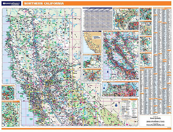 Scale 1:104,000. Size 60" W x 46" H. Laminated. Rand McNally's ProSeries wall map of Northern California is ideal for anyone needing a comprehensive representation of the state for planning, routing, or reference. It's a great choice for business and sales strategy, urban development, social work outreach, education, and marketing. Map features: ?Durable lamination for writing on and wiping off ?UV-resistant ink to help prevent color fading ?City/county index on the map ?Inset maps of major cities (see below) ?Mileage chart and driving times map between the state's main cities ?Hanging kit with rails for easy mounting just about anywhere ?Ideal for business, education, planning, or reference planning. Map indications include: ?State, federal, and county highways ?County boundaries ?Cities and towns ?Major waterways ?State and national parks ?Campsites ?Rest areas ?Military installations ?Airports ?Golf courses ?Universities ?Coverage area: Northern California. ?Inset maps: Fresno, Modesto, Monterey, Sacramento, Sacramento downtown, San Francisco, San Francisco downtown, Santa Rosa, Stockton, Sequoia & Kings Canyon National Park, and Yosemite National Park.
 - $249.95 + $24.80 p&h (add $40 for spring rollers)
Item Code : UNIV6069
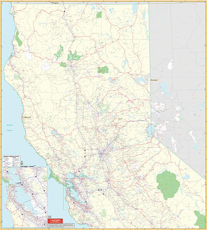
 Scale 1:660,000. Size 54" W x 54" H. Laminated. Northern California Wall Map by Universal Map covers approximately 47 counties. Uses up-to-date cartography, is printed in color, laminated, indexed on the map's face for cities/counties, and shows color-coded counties. Coverage ranges north to the state line; south to include San Jose; east to the Nevada state line including Reno; and west to the Pacific Ocean. Details all state highways, state universities, cities, towns, points of interest, longitude/latitude lines, all federal highways, military installations, state/national parks, mileage charts, county names/boundaries, major waterways, major airports, wildlife areas, and mileage circles. Framing rails are included on top and bottom for easy wall mounting. Railed wall maps can be turned into pull down maps on spring rollers for an additional $40.
 - $229.95 + $24.80 p&h (add $40 for spring rollers)
Item Code : UNIV6070
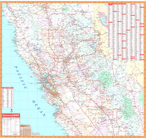 Scale 1:660,000. Size 54" W x 54" H. Laminated. The North Central California region covers approximately 40 counties. Printed in color with a markable and washable surface. Indexed on the face of the map. Mounted top and bottom with hanging rails. Area of coverage: North: to Redding in Shasta County; South: includes all of Monterey, Kings, and Tulare Counties; East: to the Nevada State line, including Reno; West: to the Pacific Ocean. Details include all state and federal highways, major waterways, state universities, military installations, major airports, cities and towns, state and national parks, wildlife areas, mileage charts, mileage circles, longitude and latitude lines, county names and boundaries, exit numbers, and points of interest. Railed wall maps can be turned into pull down maps as a $40 option.
 - $229.95 + $24.80 p&h (add $40 for spring rollers)
Item Code : UNIV6071
 Scale 1:17,111. Size 54" W x 60" H. Laminated. The Northern California Vicinity Wall Map by Universal Map. Printed in color with a markable and washable laminated surface. Cities are indexed and included in seperate index book and insets include San Francisco/Oakland. Coverage extends north to Crescent City and Dorris, south to include Santa Cruz and Madera, east to South Lake Tahoe and Mammoth Lakes, and west to include Arcata and San Francisco. Details include major streets and all highways, ZIP codes and boundaries, latitude and longitude lines, county lines and names, parks and amusement centers, water features, government buildings and federal penitentiaries, military instiutions and airports, and mileage circles. Railed wall maps can be turned into pull down maps on spring rollers for an additional $40.
 - $249.95 + $24.80 p&h (add $40 for spring rollers)
Item Code : UNIV6072
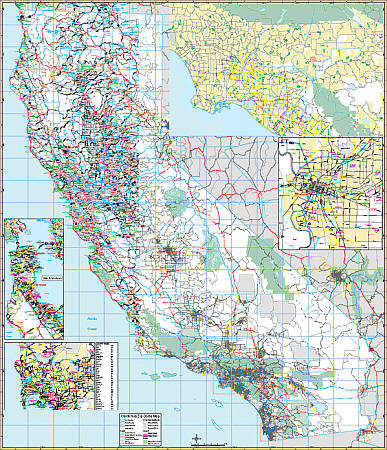
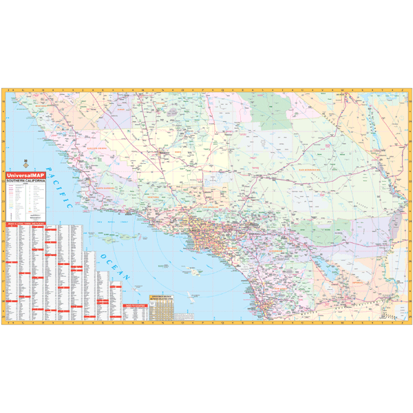 Scale 1:660,000. Size 59" W x 36" H. Laminated. Provides a laminated surface that is both markable and washable. Cities and the color-coded counties are indexed on the face of the map. The area of coverage includes all of the following nine counties: Imperial, Kern, Los Angeles, Orange, Riverside, San Bernardino, San Diego, San Luis Obispo, Santa Barbara, and Ventura. Details include all state and federal highways, major waterways, state universities, military installations, major airports, cities and towns, state/national parks, wildlife areas, mileage charts, mileage circles, county names and boundaries, longitude/latitude lines, exit numbers, and points of interest. Framing rails are included on top and bottom for easy wall mounting. Railed wall maps can be turned into pull down maps on spring rollers for an additional $40.
 - $259.95 + $24.80 p&h
Item Code : RAND6073
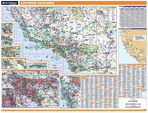 Scale 1:104,000. Size 60" W x 46" H. Laminated. Rand McNally's ProSeries wall map of Southern California is ideal for anyone needing a comprehensive representation of the state for planning, routing, or reference. It's a great choice for business and sales strategy, urban development, social work outreach, education, and marketing. Map features: ?Durable lamination for writing on and wiping off ?UV-resistant ink to help prevent color fading ?City/county index on the map ?Inset maps of major cities (see below) ?Mileage chart and driving times map between the state's main cities ?Hanging kit with rails for easy mounting just about anywhere ?Ideal for business, education, planning, or reference planning. Map indications include: ?State, federal, and county highways ?County boundaries ?Cities and towns ?Major waterways ?State and national parks ?Campsites ?Rest areas ?Military installations ?Airports ?Golf courses ?Universities ?Coverage area: Southern California. ?Inset maps: Bakersfield, Joshua Tree National Park, Lancaster/Palmdale, Los Angeles, Los Angeles downtown, Oceanside, Oxnard/Ventura, Palm Springs, San Diego, San Diego downtown, and Santa Barba.
| Postage and handling is $3.50 for the first map and $1.50 for each additional map. ~ ~ ~ ~ ~ ~ Foreign delivery is $7.80 for the first map and $5.00 for each additional map. |
| ** Click here! to view our beautiful collection of California Travel VIDEOS ** |
Rediscover California with all new California Road Maps
California is the most populous state of the U.S and third largest in area. It is a destination worth visiting for everyone.
Whether you are geeky or adventurous, California has at least one must-visit place for you. California is a state with hot deserts, beautiful hills as well as mesmerizing beaches. Experience the marvels of nature by taking a road trip to California.
There is Disneyland to fulfil your childhood wish of meeting your favorite characters. The movie buffs should definitely pay a visit to Hollywood. For the fans of Baywatch and the lovers of nature, Malibu beaches are your go to place.
Live the history of California by visiting the Golden Gate Bridge. Don’t forget the hills of San Francisco. Do pay a visit to California State Rail Road Museum. It is the largest museum of its kind in the whole of North America. If you love wine, visiting Napa Valley should be on the top of your to-do list. To satiate your adventurous nature, visit Tahoe Lake for amazing water sports and skiing. And who can forget the Silicon Valley, the house of all tech giants and a dream job location for many.
California houses plenty of national parks and state parks too. California offers natural beauty, adventure sports, historical places, everything in one state. There are so many places to visit in California. A trip to California is a must for everyone.
So what say! Fancy a road trip to California? Use this incredible all new California Road map. It maps all the must-watch destinations as well as some lesser known destinations. The map is created using modern technology and the results given are accurate.
What’s the wait then? Let’s pack our bags and rediscover California like never before.
California Road Maps for Tourists and TravelersDetailed Road Map of CaliforniaBuy travel maps for California tourist attractions, road trips, street guide, driving directions and more |
| What you’ll find in this section, all arranged in the following order: a. California States Maps and Atlases (see below) b. Recreation and Special Interest Tourist Maps of California Click Here c. California County Road Maps and Atlases Click Here d. City Street Plans and Atlases of California ~ A to L Click Here e. City Street Plans and Atlases of California ~ M to San Diego Click Here f. City Street Plans and Atlases of California ~ San Francisco to Z Click Here Please look down the list and find the map or atlas of your choice! |
