
California City Maps S to Z | Detailed Travel Tourist Street
Exploring California through city maps- San Francisco to Z.
The most populous state of the powerful country U.S., California is the most culturally diverse area of U.S. It is the third largest state of U.S. in terms of area and has beautiful forests and beaches.
California, due to its mesmerizing beauty, has always been the favorite tourist place for people across the globe. Moat area of this state has the Mediterranean climate. However, people find it amusing as there are beaches to chill out in summers and forests to enjoy winters.
Apart from this, California is also rich in infrastructure. It has the Hollywood entertainment industry in Los Angeles and the popular Golden Gate Bridge in San Francisco. San Francisco is the hilly area of California. It is one of the most beautiful counties of California.
California has many counties, cities and towns, one of them being San Francisco. It is named after St. Francis of Assisi.
San Francisco is said to be the cultural, financial and commercial center of northern California. It is the most popular tourist places in California because of its extremely cool weather and rich habitat. San Francisco is known by various names such as San Fran, Fog city, The city of Bay, The Paris of West and many more.
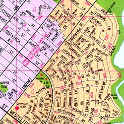
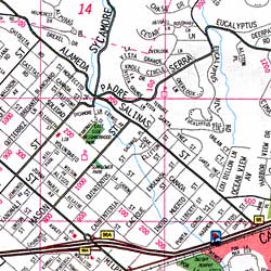
The tourism for San Francisco is open through out the year due to its leasing environment. Only concern for the people is the fog in the city because this city can be really foggy during some times of the year. It is highly recommended to hire guides while visiting San Fran because there are many astonishing places that are not much popular but you will be stunned after visiting them. City maps also help here. The maps have all guide lines and all land marks marked so that you miss none of them.
California City Street Maps for Tourists and TravelersDetailed Road Map of California Cities (S to Z)Buy travel maps for California City tourist attractions, road trips, street guide, driving directions and more |
California City Maps, San Francisco to Z
- $10.95
Item Code : RFUS22522
 Rufus Graphics. The front side includes a detailed map of San Francisco, showing official bike routes, street grades, scenic routes, contours, bike rental locations, stairways, and a detailed inset map of the Presidio. The reverse has extensive text and photos to aid the visitor in getting the most out of their visit to enjoy the varied wonders of San Francisco.
 - $12.95
Item Code : GLBL22559
Scale 1:19,000. Global Graphics edition. Large scale street map, fully indexed, with insets of Fisherman's Wharf, Downtown & Golden Gate Park. - $12.95
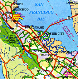
Item Code : GMJO22561

 Scale 1:25,000. Size 27"x39". G.M. Johnson edition. This Map Coverage Area are Millbrae, Pacifica, San Bruno, Yerba Buena Island, Brisbane, Burlingame*, Colma, Daly City, Hillsborough*, Half Moon Bay, San Francisco, San Mateo*, South San Francisco, Treasure Island, San Francisco International Airport, San Mateo County, * Partial Coverage.
 - $10.95
Item Code : GPAC22562
Great Pacific Recreation edition. -
- $10.95
Item Code : MEAS22587
Map Easy edition. -
- $10.95
Item Code : GPAC22564
Global Graphics edition. - $10.95
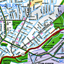
Item Code : KING5896
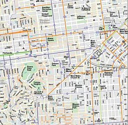
San Gabriel Valley (part of the San Francisco Metropolitan Area), and Pasadena, California, America - $259.00 Shipped rolled in a tube + $18.80 p&h
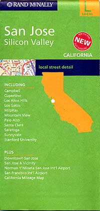
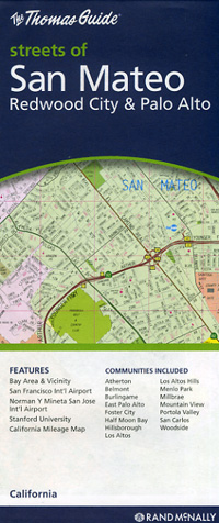
Item Code : RAND5894
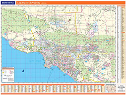
 Scale 1:95,000. Size 46"x60". Rand McNally edition. Laminated. Professional Grade.
 - $10.95
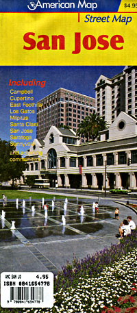
Item Code : RAND5897
 Scale 1:35,000. Size 28"x40". Rand McNally edition.
 - $10.95
Item Code : AMER5898
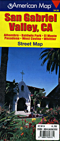
 Scale 1:31,000. Size 27"x39". American Map Company edition. This San Gabriel Valley, CA Street Map shows schools, parks, golf courses, airports, shopping centers and points of interest. It covers Alhambra, Baldwin Park, El Monte, Pasadena, West Covina and Whittier, and contains a full street index.
 - $10.95
Item Code : RAND5899
 Scale 1:36,000. Size 36"x45". Rand McNally edition.
 - $10.95
Item Code : AMER5900
 Scale 1:31,000. Size 27"x39". American Map Company edition.
 - $16.95 + $7.50 p&h or $28.50 foreign delivery
Item Code : AMER5901
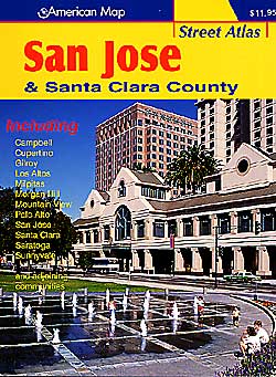
 Scale 1:22,000. Size 8?"x11". 104 pages. American Map Company edition.
 - $10.95
Item Code : RAND5902
 Scale 1:32,000. Size 27"x39". Rand McNally edition.
 - $10.95
Item Code : AMER5903
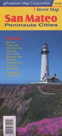
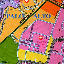
 Scale 1:32,000. Size 27"x40". American Map Company edition. Large Scale Pocket Map with Street Level detail of San Mateo, California Peninsula Cities.
 - $10.95
Item Code : AMER5904
 Scale 1:32,000. Size 27"x39". American Map Company edition.
 - $10.95
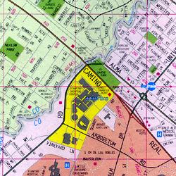
Item Code : RAND5905
 Scale 1:34,000. Size 28"x39". Rand McNally edition.
 - $10.95
Item Code : RAND5908
 Scale 1:34,000. Size 28"x39". Rand McNally edition.
| Postage and handling is $4.40 for the first map and $1.80 for each additional map. ~ ~ ~ ~ ~ ~ Foreign delivery is $15.80 for the first map and $7.60 for each additional map. ~ ~ ~ ~ ~ ~ Canada delivery is $15.80 for the first map and $7.60 for each additional map. |
Exploring California through city maps- San Francisco to Z.
The most populous state of the powerful country U.S., California is the most culturally diverse area of U.S. It is the third largest state of U.S. in terms of area and has beautiful forests and beaches.
California, due to its mesmerizing beauty, has always been the favorite tourist place for people across the globe. Moat area of this state has the Mediterranean climate. However, people find it amusing as there are beaches to chill out in summers and forests to enjoy winters.
Apart from this, California is also rich in infrastructure. It has the Hollywood entertainment industry in Los Angeles and the popular Golden Gate Bridge in San Francisco. San Francisco is the hilly area of California. It is one of the most beautiful counties of California.
California has many counties, cities and towns, one of them being San Francisco. It is named after St. Francis of Assisi.
San Francisco is said to be the cultural, financial and commercial center of northern California. It is the most popular tourist places in California because of its extremely cool weather and rich habitat. San Francisco is known by various names such as San Fran, Fog city, The city of Bay, The Paris of West and many more.
The tourism for San Francisco is open through out the year due to its leasing environment. Only concern for the people is the fog in the city because this city can be really foggy during some times of the year. It is highly recommended to hire guides while visiting San Fran because there are many astonishing places that are not much popular but you will be stunned after visiting them. City maps also help here. The maps have all guide lines and all land marks marked so that you miss none of them.
California City Street Maps for Tourists and TravelersDetailed Road Map of California Cities (S to Z)Buy travel maps for California City tourist attractions, road trips, street guide, driving directions and more |
