
California City Maps M to R | Detailed Travel Tourist Street
Exploring California through city maps- M to San Diego.
The third largest state of U.S. California is a house of huge cultural diversities. It is one of the most astonishing places of united states and its beauty and cultural diversity leave people stunned.
The state has an area of about 163,696 sq mi and due to such large area, the climate varies a lot. California has a total 58 counties which can be termed as both cities and towns because Californian law makes no distinction between city and a town.
From ancient times, California has only seen growth. Its movie industry in Los Angeles has been attracting people from all over the world. It also has one of the most popular universities of the world, The Stanford University. The world famous high tech silicon valley is also in California. This proves the richness of California in terms of infrastructure but this surely does not end here. California has a lot of beautiful places, landscapes, rivers and mountainous regions.
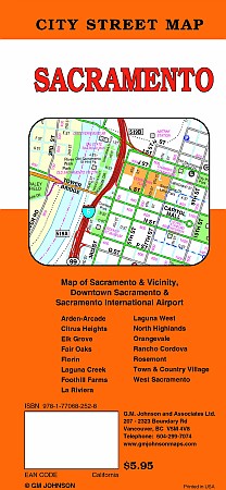
California is divided into various regions such as central, northern, eastern, coastal, southern, inland, imperial etc. There are many famous cities such as Modesto, Nevada, Sacramento(capital), San Francisco, Woodland etc.
However, the immigration rate has dropped down because of lack of job opportunities for unskilled workers. It has 72.9% of white population and western culture is followed there. California has a really large economy when compared to other large countries.
Inspite of such wide culture and area, the maps covers all of the areas with minute details. The California city maps clearly show the orientation and geography. The topography of California can be studied easily with the help of these maps.
Complete directions with compass directions and latitudes and longitudes is stated to make the traveling in California easy.
California City Street Maps for Tourists and TravelersDetailed Road Map of California Cities (M to S)Buy travel maps for California City tourist attractions, road trips, street guide, driving directions and more |
California City Maps, M to San Diego
- $10.95
Item Code : AMER5872

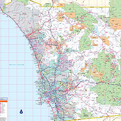
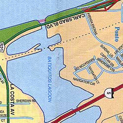 Scale 1:32,000. Size 27"x39". American Map Company edition. Includes Encinitas, Poway, Del Mar, La Jolla, Solano Beach, and adjoining communities.
 - $10.95
Item Code : RAND5873
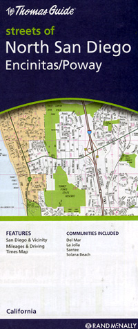
 Scale 1:35,000. Size 27"x39". Rand McNally edition. Includes Encinitas, Poway, Del Mar, La Jolla, and Solano Beach.
 - $259.00 Shipped rolled in a tube + $18.80 p&h
Item Code : RAND5877
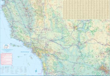
 Scale 1:120,000. Size 46"x60". Rand McNally edition. Laminated. Professional Grade.
 -
- $17.95
Item Code : ITMB22556
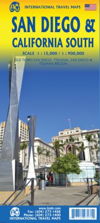
Scale 1:15,000 / 1: 900,000. Size 27"x39". International Travel Maps edition.
In the southwest corner of the American mainland is the port city of San Diego, one of the major hubs of the US Navy. The city itself is very interesting, with a city centre dominated by colonial-styled buildings. Balboa Park is home to one of the best zoos in North America, and the historic ‘old town’ area north of the city centre has become a popular ‘Old Mexico’ theme attraction.
As well, there is the Tijuana Trolley, which is, in fact, a modern surface-rail tram line that goes from the city centre to close to the walk-across border with Mexico into colourful downtown Tijuana. A day visit to Mexico is one of the highlights of a visit to San Diego! Enjoy!
- $10.95
Item Code : VDAM22576
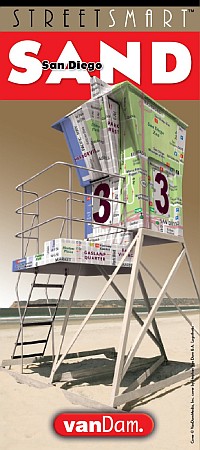
 Vandam edition. Published by the award-winning graphic artist and cartographer Stephen Van Dam, these laminated pocket maps offer superb detail in a handy pocket-sized format. The maps include shopping information, subway system information, images of major landmark buildings to help you orient yourself in the city, a street index, blow-ups of the main city-center tourist area, and much more. VanDam offers three different formats. Streetsmart is their main line of laminated detailed acordian-folded city maps. Popups are their small, shirt-pocket-sized maps with the flooming-flower-style fold pattern. The Unfolds maps are larger versions of the Popup maps and use the same blooming-flower style of folding.
 - $31.95 + $7.50 p&h or $28.50 foreign delivery
Item Code : AMER5857
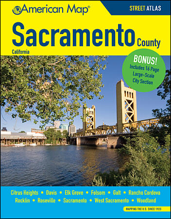 Size 8?"x11". 258 pages. American Map Company edition. This large scale atlas is fully street-indexed and shows street level detail of Sacramento County, CA. This atlas covers Citrus Heights, Davis, Elk Grove, Folsom, Galt, Rancho Cordova, Rocklin, Roseville, Sacramento, West Sacramento, and Woodland and indicates points of interest, parks, golf courses, schools, airports, shopping centers and more. It also includes a 16 page large scale Sacramento city section.
 - $249.95 + $24.80 p&h (add $40 for spring rollers)
Item Code : UNIV5862
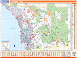
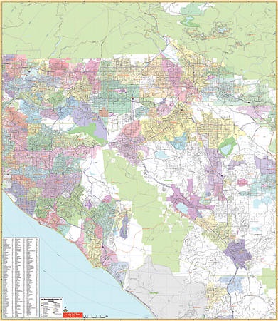 Scale 1:6,492. Size 54" W x 62" H. Laminated. Printed in color with a markable and washable laminated surface. Cities are indexed on face of the map. Details include major streets and all highways, ZIP codes and boundaries, latitude and longitude lines, county lines and names, parks, golf courses, amusement centers an stadiums, water features, government buildings and federal penitentiaries, military institutions and airports, hospitals and cemeteries, and mileage circles. Area of Coverage: North: 50 miles north of San Bernadino; South: includes San Clemente and Pauma Valley; South: East: to Hemet and Yucuipa; West to include Seal Beach and El Monte. Railed wall maps can be turned into pull down maps on spring rollers for an additional $40.
 - $249.95 + $24.80 p&h (add $40 for spring rollers)
Item Code : UNIV5878
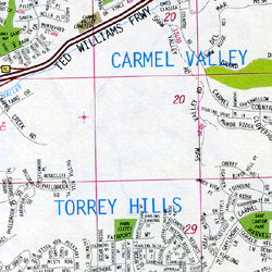
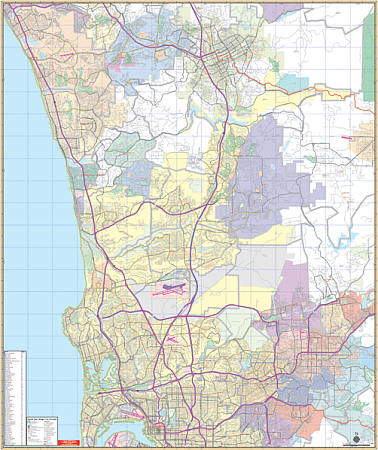 Scale 1:2,889. Laminated. The North San Diego Cailifornia Vicinity Wall Map by Universal Map includes up to date cartography and is printed in color with a markable and washable laminated surface. Cities are indexed on the face of the map. Details include major streets and all highways, ZIP codes and boundaries, latitude and longitude lines, county lines and names, parks, golf courses, amusement centers and stadiums, water features, government buildings and federal penitentiaries, military institutions and airports, hospitals and cemeteries, and mileage circles. Coverage extends north to San Marcos and Escondido, south to include San Diego and Lemon Grove, east to Johnstown and Fernbrook, and west to the Pacific Ocean. Railed wall maps can be turned into pull down maps on spring rollers for an additional $40.
 - $249.95 + $24.80 p&h (add $40 for spring rollers)
Item Code : UNIV5879
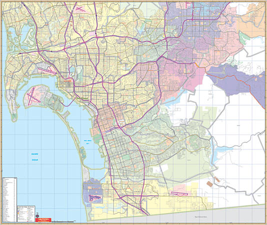 Scale 1:2,816. Size 60" W x 72" H. Laminated. Printed in color with a markable and washable laminated surface. Cities are indexed on the face of the map. Details include major streets and all highways, ZIP codes and boundaries, latitude and longitude lines, county lines and names, parks, gold courses, amusement centers and stadiums, water features, government buildings and federal penitentiaries, military institutions and airports, hospitals and cemeteries, and mileage circles. Coverage includes cities of Carlsbad,Del Mar, Encinitas, Escondido, Oceanside, Poway, Ramoma, San Marcos, Solana Beach, and Vista, Temecula in Riverside Co. Proceeds North: to include San Diego/Riverside Co line; South: includes Del Mar and Mira Mesa & Torrey Pines State park; East: Ramona airport; West: to the Pacific Ocean. Includes inset: Temecula, Ramona, & San Diego Country Estates. Railed wall maps can be turned into pull down maps on spring rollers for an additional $40.
 -
- $12.95
Item Code : TOMH5869
Scale 1:100,000. Tom Harrison Press edition - $10.95
Item Code : KING5880
King of the Road edition.

Exploring California through city maps- M to San Diego.
The third largest state of U.S. California is a house of huge cultural diversities. It is one of the most astonishing places of united states and its beauty and cultural diversity leave people stunned.
The state has an area of about 163,696 sq mi and due to such large area, the climate varies a lot. California has a total 58 counties which can be termed as both cities and towns because Californian law makes no distinction between city and a town.
From ancient times, California has only seen growth. Its movie industry in Los Angeles has been attracting people from all over the world. It also has one of the most popular universities of the world, The Stanford University. The world famous high tech silicon valley is also in California. This proves the richness of California in terms of infrastructure but this surely does not end here. California has a lot of beautiful places, landscapes, rivers and mountainous regions.
California is divided into various regions such as central, northern, eastern, coastal, southern, inland, imperial etc. There are many famous cities such as Modesto, Nevada, Sacramento(capital), San Francisco, Woodland etc.
However, the immigration rate has dropped down because of lack of job opportunities for unskilled workers. It has 72.9% of white population and western culture is followed there. California has a really large economy when compared to other large countries.
Inspite of such wide culture and area, the maps covers all of the areas with minute details. The California city maps clearly show the orientation and geography. The topography of California can be studied easily with the help of these maps.
Complete directions with compass directions and latitudes and longitudes is stated to make the traveling in California easy.
California City Street Maps for Tourists and TravelersDetailed Road Map of California Cities (M to S)Buy travel maps for California City tourist attractions, road trips, street guide, driving directions and more |
