
Arizona Road Maps | Detailed Travel Tourist Driving
Get to Know about Arizona Through Elaborate and Informative Maps
Arizona is the 6th biggest and the 14th densely populated state in the US. It is situated in the Rocky Mountainous southwestern area of the United States. The whole area of this state is 114,000 sq mi (295,260 sq km), out of which land occupies 113,508 sq mi (293,986 sq km) plus 492 sq mi (1,274 sq km) is of inland water. At times the state of Arizona is referred as America’s Italy.
Arizona is spread over an area of 113,990 square miles. The boundaries of the state are shared with the US states of California, Utah, Nevada, New Mexico and a single common point with Colorado. The borders of the state are shared with Mexico as well. Phoenix, the biggest state of Arizona is the capital as well. Arizona is, in addition, acknowledged as the Grand Canyon State. A few of the well-maintained meteorite impact sites of the world is also found in Arizona.
Tourists spots of Arizona
Grand Canyon which its stunning scenery is one among the most popular tourist spots. The wrecks of 3 early Spanish colonial missions are being conserved at the National Historical Park of Tumacacori. 30 different and varied species of cactus can be found at Organ Pipe Cactus National Monument. There are more places which are worth visiting like Jerome, Havasu Falls, Bisbee, Canyon De Chelly National Monument, Petrified Forest National Park, Saguaro National Park, among others.
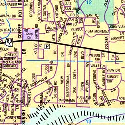
Arizona Map
Arizona, a very popular weekend escape spot for those who live in the desert is a place to escape the wrath of the sun during summer from the Phoenix plus Scottsdale region. You can very easily and interestingly know a lot about Arizona with our detailed and instructive map. The Map of Arizona will acquaint you with each and every minute details of Arizona.
Arizona Road Maps for Tourists and TravelersDetailed Road Map of ArizonaBuy travel maps for Arizona tourist attractions, road trips, street guide, driving directions and more |
Arizona
- $11.95
Item Code : UNIV5014
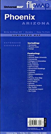
 Scale 1:38,000. Size 11"x30". Universal Map edition. Laminated.
 - $10.95
Item Code : RAND5017
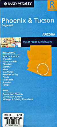
 Scale 1:140,000. Size 18"x27". Rand McNally edition. Detailed city street map.
 - $10.95
Item Code : MEAS5018
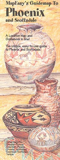
 "various scales". Size 14"x18". Map Easy edition. Perfect for the intrepid or armchair traveller, this charming map combines the best of a guidebook and a location map, all in one. The map is color coded to include information about the city's hotels, restaurants, shops, and sites. Printed on tear-proof, water-resistant, lightweight, paper-like plastic, that is incredibly durable. Also includes sketches of the landscape and interesting details about the area. You'll love this map!
 - $10.95
Item Code : NORT5023

 Scale 1:31,000. Size 18"x27". North Star edition.
 - $10.95
Item Code : NORT5024
 Scale 1:31,000. Size 18"x27". North Star edition.
 - $14.95
Item Code : GMJO5025
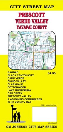
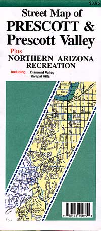
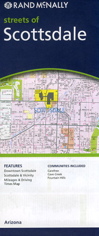
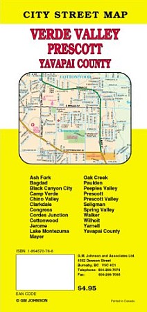 G.M. Johnson edition. This folded map is a full color and easy to read street map of Prescott, Verde Valley and Yavapai County. Also included are Bagdad, Black Canyon City, Camp Verde, Chino Valley, Clarkdale, Cottonwood, Lake Montezuma, Oak Creek, Prescott Valley and adjoining communities and vicinity map. Produced with the latest computer mapping technology, this map is accurate and current. Includes an easy to use index listing all streets and selected features which contains schools, parks, shopping centers, golf courses, city boundaries and other useful information.
 - $10.95
Item Code : RAND5026
 Scale 1:32,000. Size 18"x29". Rand McNally edition.
 - $10.95
Item Code : AMER5009
 Size 5"x10" (folded). American Map Company edition. Laminated. Out-of-towners can travel with confidence when using Slicker maps. Easy-to-handle, easy-to-read, slicker maps unfold in a flash. The durable, markable format allows you to plot your trip on the map and wipe it clean for future travels.
 - $11.95
Item Code : AMER5015
 Size 5"x10" (folded). American Map Company edition. Laminated. Out-of-towners can travel with confidence when using Slicker maps. Easy-to-handle, easy-to-read, slicker maps unfold in a flash. The durable, markable format allows you to plot your trip on the map and wipe it clean for future travels.
 - $31.95 + $7.50 p&h or $28.80 foreign delivery
Item Code : AMER5020
 Size 8?"x11". 359 pages. Indexed. American Map Company edition. Laminated. Our New Street Atlas Has It All! Up-To-Date Streets, Towns, and Places of Interest NEW Large-Sized City Maps including Gas Stations and Parking Easy-To-Use Color Coded Sections The Perfect Complement to Your GPS System Up-To-Date Features Block Numbers ZIP Codes Shopping Centers Golf Courses and Country Clubs Schools and Universities Parks Airports Hospitals Cemeteries and much more...
 - $229.95 + $24.80 p&h (add $40 for spring rollers)
Item Code : UNIV5021
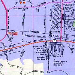
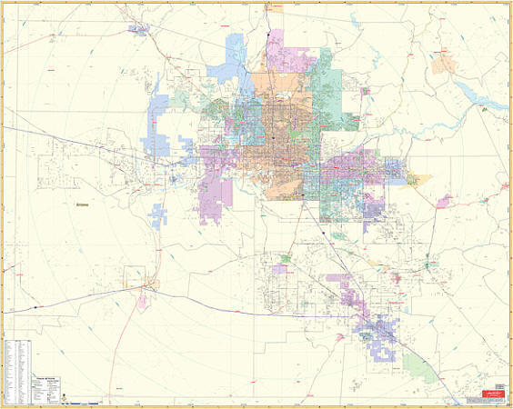 Scale 1:210,000. Size 54" W x 66" H. Laminated. Printed in color with a markable and washable laminated surface. Cities are indexed on the face of the map. Hanging rails mounted top and bottom for your convenience. Railed wall maps can be turned into pull down maps on spring rollers for an additional $40. The area of coverage includea all of Maricopa County and approximately 70% of Pinal County with the following boundaries: North: to the Maricopa County line; South: to the Pinal County line; East: includes Superior City; West: to the Maricopa County line. Details include major streets and all highways, water features, zip codes and boundaries, county lines, airports, mileage circles, parks, and other points of interest.
 - $229.95 + $24.80 p&h (add $40 for spring rollers)
Item Code : UNIV5022
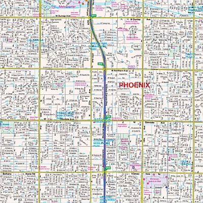
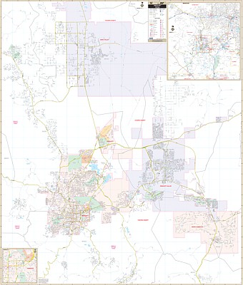
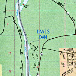
 Scale 1:3,300. Size 77" W x 54" H. Laminated. Provides up-to-date cartography with new streets and changes. Printed in color with a markable/washable-laminated surface. Streets indexed in a separate book. Complete with Phoenix Mapping Street Guide. Mounted top and bottom with hanging rails. Area of Coverage: North: Including most of Scottsdale, north to Dynamite Blvd.; South: Includes Goodyear, Chandler, and Gilbert; East:Includes Fountain Hills and Mesa; West: Includes Goodyear, Surprise, and all of Sun City West. Inset 1: Includes apache Junction. Inset 2: Southern Gilbert and Chandler with Sunlakes & Queen Creek. Details included: airports, cemeteries, hospitals, railroads, post offices, block numbers, all streets and highways, shopping centers, water features, recreational parks, city limits/annexations, government buildings, fire/police stations, educational facilities, golf/country clubs, ZIP codes/boundaries, section/township/range lines, and points of interest. Railed wall maps can be turned into pull down maps on spring rollers for an additional $40.
 - $229.95 + $24.80 p&h (add $40 for spring rollers)
Item Code : UNIV5038
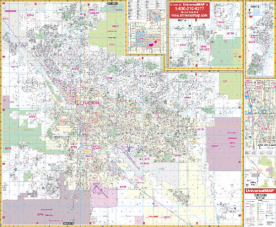 Scale 1:2,560. Size 64" W x 54" H. Laminated. Provides up-to-date cartography with new streets and changes. Printed in color with a markable/washable-laminated surface. Indexing in a separate book. Includes hanging rails mounted top and bottom. Boundaries are as follows: North: Catalina & Oro Valley. South: San Xavier Indian Reservation and Arizona St. Prison, with an inset of Green Valley; East: Saguaro National Park (East). West: Saguaro National Park (West). Map Insets include: University of Arizona and continuation of Oro Valley to include Catalina to the Pima County Line, Downtown, University of Arizona. Special features are as follows: all streets, all highways, educational facilities, government buildings, post offices, hospitals, zip codes and boundaries, shopping centers, airports, cemeteries, recreational parks, mobile home parks, golf and country clubs, points of interest, water features, mileage circles, longitude/latitude lines, subdivision names, section, township and range lines, railroads, zip codes/boundaries, city limits and annexations. Railed wall maps can be turned into pull down maps as a $40 option.
 - $26.95 + $7.50 p&h or $28.80 foreign delivery
Item Code : AMER5040
 Size 8?"x11". 240 pages. American Map Company edition. Our New Street Atlas Has It All! Up-To-Date Streets, Towns, and Places of Interest NEW Large-Sized City Maps including Gas Stations and Parking Easy-To-Use Color Coded Sections The Perfect Complement to Your GPS System Up-To-Date Features Block Numbers ZIP Codes Shopping Centers Golf Courses and Country Clubs Schools and Universities Parks Airports Hospitals Cemeteries and much more...
 - $309.95 + $24.80 p&h (add $40 for spring rollers)
Item Code : KAPA21084
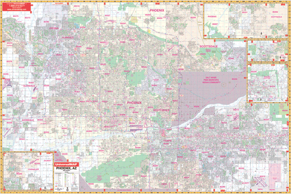
 Our Phoenix, AZ Wall Map, with adjacent areas, measures 77" x 73" (6'5" W x 6'1" H) and features up-to-date cartography, with new streets and changes in complete street detail; is printed in color, with a markable and washable laminated surface; and offers a street index in a separate book-format. The area of coverage includes the following boundaries: - North to most of Scottsdale (remaining streets on inset) - South to Phoenix City limits - East to Fountain Hills and Mesa - West to Glendale and Phoenix Glendale Municipal Airport The Phoenix, AZ Wall Map also includes insets of Apache Junction, Southern Gilbert, Chandler, and Cave Creek and the remainder of Scottsdale. Details and features include: - AIRPORTS - BLOCK NUMBERS - CEMETERIES - CITY LIMITS - EDUCATIONAL INSTITUTIONS - GOLF & COUNTRY CLUBS - GOVERNMENT BUILDINGS - HOSPITALS - LIBRARIES - POINTS OF INTEREST - POLICE STATIONS - RAILROADS - RECREATIONAL PARKS - SHOPPING CENTERS - STREETS & HIGHWAYS - WATER FEATURES - ZIP CODE BOUNDARIES Framing rails are included, top and bottom, for easy wall mounting. Spring roller mounting is also available, for an additional $40.
 - $249.95 + $24.80 p&h (add $40 for spring rollers)
Item Code : KAPA21085
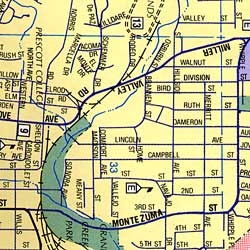
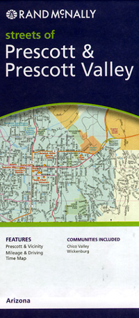
 Our Prescott, AZ Wall Map, with adjacent areas, measures 60" x 68" (5' W x 5'8" H) and features up-to-date cartography, with new streets and changes in complete street detail; is printed in color, with a markable and washable laminated surface; and offers a street index in a separate book-format. The area of coverage includes the following boundaries: - North to Road 6 North in Chino Valley - South to Community of Walker and Poland Junction - East to Dewey-Humboldt and Prescott Valley - West to Talking Rock Golf Club and the Community of Highland Park The Prescott, AZ Wall Map also includes inset maps of Yavapai County and Downtown Prescott. Details and features include: - AIRPORTS - BLOCK NUMBERS - CEMETERIES - CITY LIMITS - COMMUNITY NAMES - EDUCATIONAL INSTITUTIONS - FIRE & POLICE STATIONS - GOLF & COUNTRY CLUBS - GOVERNMENT BUILDINGS - HOSPITALS - POINTS OF INTEREST - POST OFFICES - RAILROADS - RECREATIONAL PARKS - SHOPPING CENTERS - STREETS & HIGHWAYS - WATER FEATURES - ZIP CODE BOUNDARIES Framing rails are included, top and bottom, for easy wall mounting. Spring roller mounting is also available, for an additional $40.
 - $10.95
Item Code : RAND5039
 Scale 1:34,000. Size 28"x40". Rand McNally edition.
 - $10.95
Item Code : RAND5027
 "various scales". Size 28"x40". Rand McNally edition. Detailed city street map.
 - $10.95
Item Code : RAND5030
 Scale 1:35,000. Size 28"x40". Rand McNally edition. City street map.
 - $10.95
Item Code : NORT5031
 Scale 1:32,000. Size 18"x27". North Star edition.
| Postage and handling is $4.40 for the first map and $1.80 for each additional map. ~ ~ ~ ~ ~ ~ Foreign delivery is $15.80 for the first map and $7.60 for each additional map. ~ ~ ~ ~ ~ ~ Canada delivery is $15.80 for the first map and $7.60 for each additional map. |
Get to Know about Arizona Through Elaborate and Informative Maps
Arizona is the 6th biggest and the 14th densely populated state in the US. It is situated in the Rocky Mountainous southwestern area of the United States. The whole area of this state is 114,000 sq mi (295,260 sq km), out of which land occupies 113,508 sq mi (293,986 sq km) plus 492 sq mi (1,274 sq km) is of inland water. At times the state of Arizona is referred as America’s Italy.
Arizona is spread over an area of 113,990 square miles. The boundaries of the state are shared with the US states of California, Utah, Nevada, New Mexico and a single common point with Colorado. The borders of the state are shared with Mexico as well. Phoenix, the biggest state of Arizona is the capital as well. Arizona is, in addition, acknowledged as the Grand Canyon State. A few of the well-maintained meteorite impact sites of the world is also found in Arizona.
Tourists spots of Arizona
Grand Canyon which its stunning scenery is one among the most popular tourist spots. The wrecks of 3 early Spanish colonial missions are being conserved at the National Historical Park of Tumacacori. 30 different and varied species of cactus can be found at Organ Pipe Cactus National Monument. There are more places which are worth visiting like Jerome, Havasu Falls, Bisbee, Canyon De Chelly National Monument, Petrified Forest National Park, Saguaro National Park, among others.
Arizona Map
Arizona, a very popular weekend escape spot for those who live in the desert is a place to escape the wrath of the sun during summer from the Phoenix plus Scottsdale region. You can very easily and interestingly know a lot about Arizona with our detailed and instructive map. The Map of Arizona will acquaint you with each and every minute details of Arizona.
Arizona Road Maps for Tourists and TravelersDetailed Road Map of ArizonaBuy travel maps for Arizona tourist attractions, road trips, street guide, driving directions and more |
