
Arizona Road Maps | Detailed Travel Tourist Driving
Get to Know about Arizona Through Elaborate and Informative Maps
Arizona is the 6th biggest and the 14th densely populated state in the US. It is situated in the Rocky Mountainous southwestern area of the United States. The whole area of this state is 114,000 sq mi (295,260 sq km), out of which land occupies 113,508 sq mi (293,986 sq km) plus 492 sq mi (1,274 sq km) is of inland water. At times the state of Arizona is referred as America’s Italy.
Arizona is spread over an area of 113,990 square miles. The boundaries of the state are shared with the US states of California, Utah, Nevada, New Mexico and a single common point with Colorado. The borders of the state are shared with Mexico as well. Phoenix, the biggest state of Arizona is the capital as well. Arizona is, in addition, acknowledged as the Grand Canyon State. A few of the well-maintained meteorite impact sites of the world is also found in Arizona.
Tourists spots of Arizona
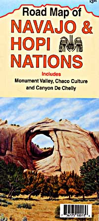
Grand Canyon which its stunning scenery is one among the most popular tourist spots. The wrecks of 3 early Spanish colonial missions are being conserved at the National Historical Park of Tumacacori. 30 different and varied species of cactus can be found at Organ Pipe Cactus National Monument. There are more places which are worth visiting like Jerome, Havasu Falls, Bisbee, Canyon De Chelly National Monument, Petrified Forest National Park, Saguaro National Park, among others.
Arizona Map
Arizona, a very popular weekend escape spot for those who live in the desert is a place to escape the wrath of the sun during summer from the Phoenix plus Scottsdale region. You can very easily and interestingly know a lot about Arizona with our detailed and instructive map. The Map of Arizona will acquaint you with each and every minute details of Arizona.
Arizona Road Maps for Tourists and TravelersDetailed Road Map of ArizonaBuy travel maps for Arizona tourist attractions, road trips, street guide, driving directions and more |
Arizona
- $17.95
Item Code : TRAL4981
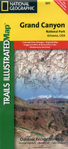
 Scale 1:63,000. Size 26"x37". Trails Illustrated edition. Printed on waterproof, tear-resistant, lightweight, paper-like, plastic. This map slightly overlaps with Grand Canyon East and contains detailed coverage from the high visitation areas just west of the Grand Canyon Visitor Center to the western boundary of the park at Lake Mead. The map features detailed and easy-to-read trail and road networks, locations of facilities, points of interest, and highly accurate terrain with thousands of feature names. Official Grand Canyon Backcountry Use Areas are shown, coded by degree of experience required. Suggested hikes and itineraries, important park regulations, safety tips and contact information make these maps an invaluable resource. Coverage highlights: Colorado River Miles 110-278, Havasu Falls, Mt. Trumbull Wilderness, Mt. Logan Wilderness, Parashant National Monument, Kaibab National Forest, Dead Horse Mesa, Timp Point, Hualapai Indian Reservation, Route 103, Kelly Point, Parashant Canyon Route, Joshua Tree Forest, Grand Wash Cliffs, and more. Not available for shipment outside of the U.S. and Canada.
 - $12.95
Item Code : EART4980
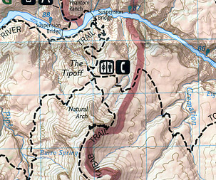
 Scale 1:48,000. Earthwalk Press edition. Detailed topographic and hiking map of the Grand Canyon. The map includes two maps; one for Bright Angel Trail (1:24,000) and one for Hermit Trail to Grandview Trail.
 - $17.95
Item Code : TRAL4978
 Scale 1:177,000. Size 26"x37". Trails Illustrated edition. Printed on waterproof, tear-resistant, lightweight, paper-like, plastic.
 - $10.95
Item Code : RFUS4958
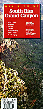
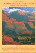
 Scale 1:550,000. Size 10?"x37". Rufus Graphics edition. Everything you'd like to know for your visit to the South Rim of the Grand Canyon. Includes history, hiking trails, accomodations, and much more.
 - $24.95 Rolled + $8.80 p&h or $36.80 foreign delivery
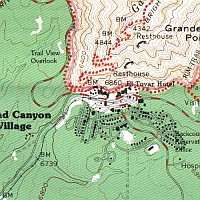
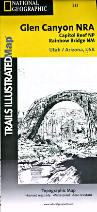
Item Code : NATL4985
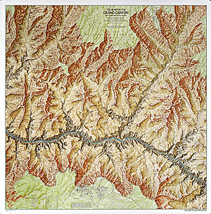
 Scale 1:24,000. Size 36"x38". National Geographic edition.
 - $16.95
Item Code : NATL21010
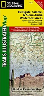
 Scale 1:70,000. Size 26"x38". National Geographic edition. One of the most-visited urban forests in the U.S., with approximately 5.8 million visitors annually, the Tonto National Forest spans almost 3 million acres of diverse terrain just outside of Phoenix, AZ. Tonto encompasses a wide variety of vegetation ranging from cactus-studded desert to pine-forested mountains, and numerous recreational opportunities throughout the year. Our four new Trails Illustrated maps are the most detailed and up-to-date for the forest, carefully researched and developed in co-operation with local land managers and agencies. Each map contains easy to read trails, numbered forest service roads, campsites, access points, scenic points-of-interest, and important facilities. Like all Trails Illustrated maps our new Tonto National Forest titles are both highly durable and environmentally friendly. Each map is printed in the United States, at a certified green printer, using low V.O.C. inks on waterproof, tear-resistant material. Coverage Highlights: Highline & General Crook National Recreation Trails; Arizona Trail; Desert to the Tall Pines Scenic Byway; Roosevelt Lake & Wildlife Area; Portions of Coconino and Apache - Sitgreaves National Forests; Locations of Public Facilities and Fee Areas; Motorized and Non-Motorized Trails; Equestrian & Multiple Use Trails; Mogollon Rim Area and Sierra Ancha Mountains; Hellsgate, Salome & Sierra Ancha Wilderness Areas; Tonto Natural Bridge State Park; Payson, Pleasant Valley, and Tonto Basin Ranger Districts; Agency Contact and Recreation Information.
 - $10.95
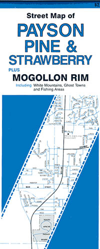
Item Code : NORT5005
 "Various scales". Size 18"x27". North Star edition.
 - $16.95
Item Code : NATL21076
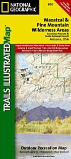
 Scale 1:70,000. Size 26"x38". National Geographic edition. One of the most-visited urban forests in the U.S., with approximately 5.8 million visitors annually, the Tonto National Forest spans almost 3 million acres of diverse terrain just outside of Phoenix, AZ. Tonto encompasses a wide variety of vegetation ranging from cactus-studded desert to pine-forested mountains, and numerous recreational opportunities throughout the year. Our four new Trails Illustrated maps are the most detailed and up-to-date for the forest, carefully researched and developed in co-operation with local land managers and agencies. Each map contains easy to read trails, numbered forest service roads, campsites, access points, scenic points-of-interest, and important facilities. Like all Trails Illustrated maps our new Tonto National Forest titles are both highly durable and environmentally friendly. Each map is printed in the United States, at a certified green printer, using low V.O.C. inks on waterproof, tear-resistant material. Coverage Highlights: Agua Fria National Monument; Verde Wild & Scenic River; Arizona and Great Western Trails; Bartlett & Horseshoe Reservoirs; Black Canyon National Recreation Trail; Portions of Coconino and Prescott National Forests; Locations of Public Facilities and Fee Areas; Motorized and Non-Motorized Trails; Equestrian & Multiple Use Trails; Mogollon Rim Area and Mazatzal Mountains; Mazatzal & Pine Mountain Wilderness Areas; Tonto Natural Bridge State Park; Payson, Cave Creek, Mesa and Tonto Basin Ranger Districts; Agency Contact and Recreation Information.
 - $17.95
Item Code : TRAL4991
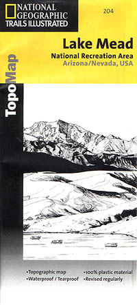
 Scale 1:167,000. Size 25"x38". Trails Illustrated edition. Printed on waterproof, tear-resistant, lightweight, paper-like, plastic. This Trails Illustrated topographic map is the most comprehensive and complete recreational map for the Lake Mead National Recreation Area, located in Nevada and Arizona.
 - $10.95
Item Code : NORT5006
 Scale 1:31,000. Size 18"x27". North Star edition.
 - $10.95
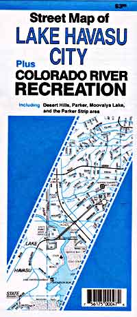
Item Code : RAND5008
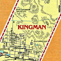
Mesa and Adjacent Cities, Arizona, America - $10.95
Item Code : RAND5007
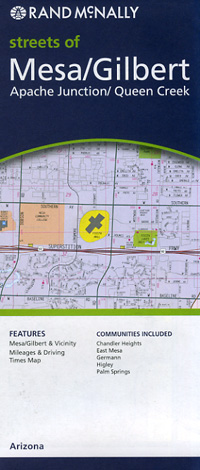
 Scale 1:35,000. Size 28"x40". Rand McNally edition. Detailed city street map. This detailed map of Mesa and Tempe, Arizona has complete coverage for the cities and surrounding area, with an inset map for downtown, plus most major tourist and business districts. When you flip the map over, you will find a complete street index and a "city and vicinity" map of the entire metro area.
 - $16.95
Item Code : NATL4992
Scale 1:70,000. Size 26"x38". National Geographic edition. One of five new Trails Illustrated maps for Coconino and Prescott National Forests in Arizona offering the most detailed and up-to-date map for the forest. Our maps are carefully researched and developed in co-operation with local land managers and agencies. Each map contains easy to read trails, numbered forest service roads, campsites, access points, scenic points-of-interests, and important facilities. Coverage Highlights: Fossil Springs, West Clear Creek & Wet Beaver Wilderness Areas, General George Crook & Highline National Recreation Trails, Verde Wild & Scenic River, Red Rock Scenic Byway Wilderness Coverage: Fossil Springs, Munds Mountain, West Clear Creek, Wet Beaver Other Attractions: Sedona-Oak Creek Canyon Scenic Road, Arizona Trail, hiking trails, mountain biking, campgrounds, horseback riding, archaeological sites, fishing, prospecting, day use areas, OHV areas - $10.95
Item Code : NORT4954
 Scale 1:775,000. Size 18"x27". North Star edition.
 - $17.95
Item Code : TRAL4993
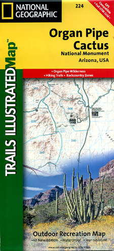
 Scale 1:69,000. Size 26"x38". Trails Illustrated edition. Printed on waterproof, tear-resistant, lightweight, paper-like, plastic. This Trails Illustrated topographic map for Organ Pipe Cactus National Monument, straddling southern Arizona, and northern Sonora, Mexico, is the perfect recreational map for this beautiful Sonoran desert wilderness. The map includes the entire Organ Pipe Cactus national monument area, with detailed topographic information. Included on the map are the Ajo Range, the Ajo Mountain Drive, Arch Canyon, Bates Mountains, Cipriano Hills, the Puerto Blanco Mountains, and much more. Includes UTM grids for use with your GPS unit.
 - $10.95
Item Code : NORT5010
 Scale 1:31,000. Size 18"x27". North Star edition.
 - $17.95
Item Code : NORT4995
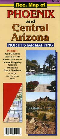
 Scale 1:600,000. Size 18"x27". North Star edition.
 - $17.95
Item Code : BORC5011

 Scale 1:20,000. Size 25"x30". Borch edition. Laminated, easy-fold, flexi-map. Detailed city street map. Legend includes sights, museums, churches, ski areas, international/regional airports, airfields, golf courses, bus stations, national parks, national monuments, nature reserves, camping sites, viewpoints, prohibited areas, Indian reservations, hotels, markets. Includes inset map of Downtown Phoenix (1:20,000), Downtown Scottsdale (1:20,000), Arizona (1:3.050,000), Heritage Square (1:3,000) and Sky Harbor Int'l Airport (1:37,500). Climate charts show the average daily temperatures, humidity, hours of sunshine and precipitation for each month.
 - $10.95
Item Code : RAND5012

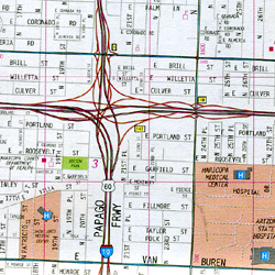 Scale 1:34,000. Size 28"x40". Rand McNally edition. Rand McNally's folded map for Phoenix is a must-have for anyone traveling in and around this part of Arizona, offering unbeatable accuracy and reliability at a great price. Our trusted cartography shows all Interstate, U.S., state, and county highways, along with clearly indicated parks, points of interest, airports, county boundaries, and streets. The easy-to-use legend and detailed index make for quick and easy location of destinations. You'll see why Rand McNally folded maps have been the trusted standard for years.
 - $10.95
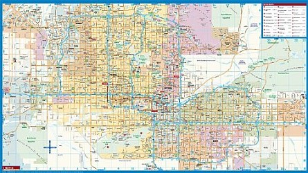
Item Code : UNIV5013
 Scale 1:40,000. Size 28"x40". Universal Map edition.
| Postage and handling is $4.40 for the first map and $1.80 for each additional map. ~ ~ ~ ~ ~ ~ Foreign delivery is $15.80 for the first map and $7.60 for each additional map. ~ ~ ~ ~ ~ ~ Canada delivery is $15.80 for the first map and $7.60 for each additional map. |
Get to Know about Arizona Through Elaborate and Informative Maps
Arizona is the 6th biggest and the 14th densely populated state in the US. It is situated in the Rocky Mountainous southwestern area of the United States. The whole area of this state is 114,000 sq mi (295,260 sq km), out of which land occupies 113,508 sq mi (293,986 sq km) plus 492 sq mi (1,274 sq km) is of inland water. At times the state of Arizona is referred as America’s Italy.
Arizona is spread over an area of 113,990 square miles. The boundaries of the state are shared with the US states of California, Utah, Nevada, New Mexico and a single common point with Colorado. The borders of the state are shared with Mexico as well. Phoenix, the biggest state of Arizona is the capital as well. Arizona is, in addition, acknowledged as the Grand Canyon State. A few of the well-maintained meteorite impact sites of the world is also found in Arizona.
Tourists spots of Arizona
Grand Canyon which its stunning scenery is one among the most popular tourist spots. The wrecks of 3 early Spanish colonial missions are being conserved at the National Historical Park of Tumacacori. 30 different and varied species of cactus can be found at Organ Pipe Cactus National Monument. There are more places which are worth visiting like Jerome, Havasu Falls, Bisbee, Canyon De Chelly National Monument, Petrified Forest National Park, Saguaro National Park, among others.
Arizona Map
Arizona, a very popular weekend escape spot for those who live in the desert is a place to escape the wrath of the sun during summer from the Phoenix plus Scottsdale region. You can very easily and interestingly know a lot about Arizona with our detailed and instructive map. The Map of Arizona will acquaint you with each and every minute details of Arizona.
Arizona Road Maps for Tourists and TravelersDetailed Road Map of ArizonaBuy travel maps for Arizona tourist attractions, road trips, street guide, driving directions and more |
