
Alberta Road Maps | Detailed Travel Tourist Driving
Alberta - Visit the Impressive Entrepreneurial Province
People from all over the world choose to live and work in Alberta because of the diverse communities, high standard of living and beautiful landscapes along with sustainability, economic growth, and job creation all makes it the Entrepreneurial province of Canada.
Alberta is the western province of Canada and is the fourth-most populous. It’s 661,848-square kilometer is enclosed by Saskatchewan in the east, by the Northwest Territories in the north, by British Columbia in the west, and by Montana in the south.
The landscape of Alberta comprises not only of mountains, prairies, deserts, coniferous forest, but also gently sloping wheat fields, vast granaries, expansive cattle ranches, and huge oil refineries.Agriculture is Alberta's economic backbone.
The largest city is Calgary and Edmonton, the capital city is the second largest.Other prominent cities are Fort McMurray, Lethbridge, Medicine Hat, Red Deer, and St. Albert.
It has attractions like skiing, hiking, and camping, shopping spots like the West Edmonton Mall, Calgary Stampede the rodeo exhibition and festival as well as athletic and sporting competitions. The Elk Island National Park, Wood Buffalo National Park, and the Columbia Icefield are natural attractions.
Banff has been identified as one of the Best World Destinations for 2017 by National Geographic Traveler magazine.The Banff National Park is well-known for wildlife, its Canadian Rocky Mountain beauty, and entertainment prospects with more than four million travelers every year.
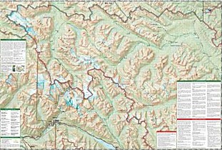
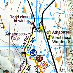
The 10,000-square km Jasper National Park is the largest wilderness park in the Canadian Rockies and is the largest easily accessible Dark Sky Preserve in the world and it is a four-hour drive from Edmonton.Visit Alberta with a map and enjoy everything the Park offers like the ‘star gazing’ experience, Sidewalk Astronomy Roves in the daytime all through summer, and interpretations in the fall like Mysteries of the Night to enhance visitors.
Alberta Road Maps for Tourists and TravelersDetailed Road Map of AlbertaBuy travel maps for Alberta tourist attractions, road trips, street guide, driving directions and more |
Alberta
- $12.95
Item Code : GEMT4670

 Scale 1:50,000. Size 27"x39". Gem Trek edition.
 - $12.95
Item Code : GEMT4671
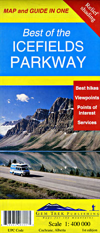
 Scale 1:400,000. Size 18"x24". Gem Trek edition.
 - $16.95
Item Code : NATL20948
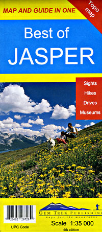
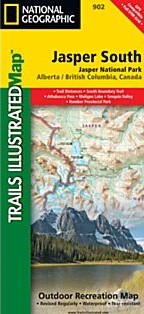 Scale 1:100,000. Size 26"x38". National Geographic edition. National Geographic's Trails Illustrated map of Jasper South—Jasper National Park in Alberta and British Columbia, Canada—is a two-sided, waterproof map designed to meet the needs of outdoor enthusiasts with unmatched durability and detail. This map was created in conjunction with local land management agencies and is loaded with valuable recreation information. The front side of the Jasper South map details the east side of the national park, from Whitehorse Wildland Provincial Park to the north, to White Goat Wilderness Area to the south. The reverse side of the map details the west side of the park, extending from Cummins Lakes Provincial Park to the south, to Victoria Cross Ranges to the North. Insets show survival tips, safe travel in Bear Country, and all the recreation the park has to offer with backpacking, camping, biking, hiking and horseback riding.
 - $16.95
Item Code : NATL21011

 Scale 1:100,000. Size 26"x38". National Geographic edition. National Geographic's Trails Illustrated map of Jasper North—Jasper National Park in Alberta and British Columbia, Canada—is a two-sided, waterproof map designed to meet the needs of outdoor enthusiasts with unmatched durability and detail. This map was created in conjunction with local land management agencies and is loaded with valuable recreation information. The front side of Jasper North map details the east side of the national park, from Rock Lake Solomon Creek Wildland Park to the north, to Whistler’s Summit to the south. The reverse side of the map details the west side of the park, extending from Mt. Terry Fox Provincial Park to the south, to Willmore Wilderness Park to the North. Insets show survival tips, safe travel in Bear Country, and what to do while visiting.
 - $12.95
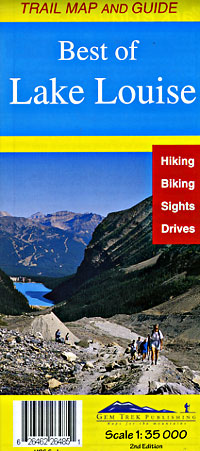
Item Code : GEMT4672
 Scale 1:35,000. Size 18"x24". Gem Trek edition.
 - $12.95
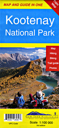
Item Code : GEMT4673
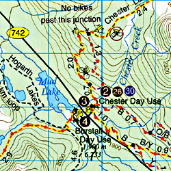
 Scale 1:100,000. Size 27"x39". Gem Trek edition.
 - $17.95
Item Code : ITMB4674
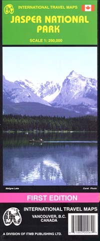
 Scale 1:250,000. International Travel Maps edition. Beautiful map. Elevation and topographic features are shown by contour lines and hypsometric color tints. English text and legends. Lots of useful travel information.
 - $12.95
Item Code : GEMT4675
 Scale 1:50,000. Size 27"x36". Gem Trek edition.
 - $12.95
Item Code : GEMT4676
 Scale 1:100,000. Size 23"x39". Gem Trek edition.
 - $12.95
Item Code : GEMT4677
 Scale 1:35,000. Size 18"x24". Gem Trek edition.
 - $12.95
Item Code : GEMT4678
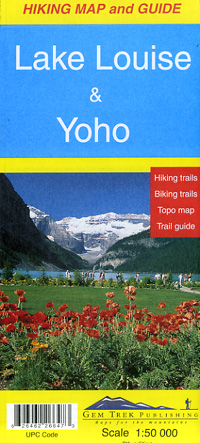
 Scale 1:50,000. Size 27"x39". Gem Trek edition.
 - $12.95
Item Code : GEMT4679
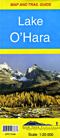
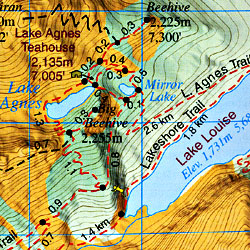
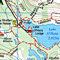 Scale 1:20,000. Size 18"x24". Gem Trek edition.
 - $14.95
Item Code : GMJO7232
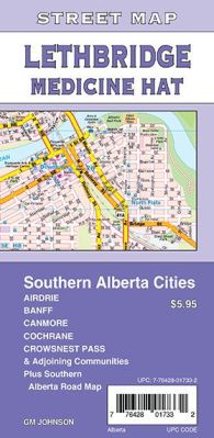
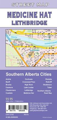 Scale 1:25,000. Size 27"x39". G.M. Johnson edition. This Map Coverage Area are Airdrie, Banff, Brooks, Canmore, Chestermere, Coaldale, Cochrane, Crowsnest Pass, High River, Lake Louise, Lethbridge, Medicine Hat, Okotoks, Redcliff, Strathmore, Taber, Southern Alberta Road Map.
 - $12.95
Item Code : mart21408
Scale 1:25,000. MapArt edition. Detailed city street map. - $12.95
Item Code : MART21428
Scale 1:25,000. MapArt edition. Detailed city street map.
| Postage and handling is $4.40 for the first map and $1.80 for each additional map. ~ ~ ~ ~ ~ ~ Foreign delivery is $15.80 for the first map and $7.60 for each additional map. ~ ~ ~ ~ ~ ~ Canada delivery is $15.80 for the first map and $7.60 for each additional map. |
| ** Click here! to view our beautiful collection of Alberta Travel VIDEOS ** |
Alberta - Visit the Impressive Entrepreneurial Province
People from all over the world choose to live and work in Alberta because of the diverse communities, high standard of living and beautiful landscapes along with sustainability, economic growth, and job creation all makes it the Entrepreneurial province of Canada.
Alberta is the western province of Canada and is the fourth-most populous. It’s 661,848-square kilometer is enclosed by Saskatchewan in the east, by the Northwest Territories in the north, by British Columbia in the west, and by Montana in the south.
The landscape of Alberta comprises not only of mountains, prairies, deserts, coniferous forest, but also gently sloping wheat fields, vast granaries, expansive cattle ranches, and huge oil refineries.Agriculture is Alberta's economic backbone.
The largest city is Calgary and Edmonton, the capital city is the second largest.Other prominent cities are Fort McMurray, Lethbridge, Medicine Hat, Red Deer, and St. Albert.
It has attractions like skiing, hiking, and camping, shopping spots like the West Edmonton Mall, Calgary Stampede the rodeo exhibition and festival as well as athletic and sporting competitions. The Elk Island National Park, Wood Buffalo National Park, and the Columbia Icefield are natural attractions.
Banff has been identified as one of the Best World Destinations for 2017 by National Geographic Traveler magazine.The Banff National Park is well-known for wildlife, its Canadian Rocky Mountain beauty, and entertainment prospects with more than four million travelers every year.
The 10,000-square km Jasper National Park is the largest wilderness park in the Canadian Rockies and is the largest easily accessible Dark Sky Preserve in the world and it is a four-hour drive from Edmonton.Visit Alberta with a map and enjoy everything the Park offers like the ‘star gazing’ experience, Sidewalk Astronomy Roves in the daytime all through summer, and interpretations in the fall like Mysteries of the Night to enhance visitors.
Alberta Road Maps for Tourists and TravelersDetailed Road Map of AlbertaBuy travel maps for Alberta tourist attractions, road trips, street guide, driving directions and more |
