
Alberta Road Maps | Detailed Travel Tourist Driving
Alberta - Visit the Impressive Entrepreneurial Province
People from all over the world choose to live and work in Alberta because of the diverse communities, high standard of living and beautiful landscapes along with sustainability, economic growth, and job creation all makes it the Entrepreneurial province of Canada.
Alberta is the western province of Canada and is the fourth-most populous. It’s 661,848-square kilometer is enclosed by Saskatchewan in the east, by the Northwest Territories in the north, by British Columbia in the west, and by Montana in the south.
The landscape of Alberta comprises not only of mountains, prairies, deserts, coniferous forest, but also gently sloping wheat fields, vast granaries, expansive cattle ranches, and huge oil refineries.Agriculture is Alberta's economic backbone.
The largest city is Calgary and Edmonton, the capital city is the second largest.Other prominent cities are Fort McMurray, Lethbridge, Medicine Hat, Red Deer, and St. Albert.
It has attractions like skiing, hiking, and camping, shopping spots like the West Edmonton Mall, Calgary Stampede the rodeo exhibition and festival as well as athletic and sporting competitions. The Elk Island National Park, Wood Buffalo National Park, and the Columbia Icefield are natural attractions.
Banff has been identified as one of the Best World Destinations for 2017 by National Geographic Traveler magazine.The Banff National Park is well-known for wildlife, its Canadian Rocky Mountain beauty, and entertainment prospects with more than four million travelers every year.
The 10,000-square km Jasper National Park is the largest wilderness park in the Canadian Rockies and is the largest easily accessible Dark Sky Preserve in the world and it is a four-hour drive from Edmonton.Visit Alberta with a map and enjoy everything the Park offers like the ‘star gazing’ experience, Sidewalk Astronomy Roves in the daytime all through summer, and interpretations in the fall like Mysteries of the Night to enhance visitors.
Alberta Road Maps for Tourists and TravelersDetailed Road Map of AlbertaBuy travel maps for Alberta tourist attractions, road trips, street guide, driving directions and more |
Alberta
- $12.95
Item Code : GEMT4662
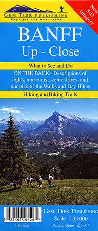
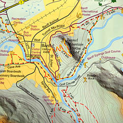 Scale 1:35,000. Size 18"x24". Gem Trek edition.
 - $16.95
Item Code : NATL20977
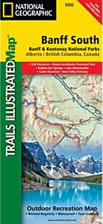
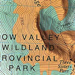
 Scale 1:100,000. Size 26"x38". National Geographic edition. National Geographic's Trails Illustrated map of Banff South is a two-sided, waterproof map designed to meet the needs of outdoor enthusiasts with unmatched durability and detail. This map was created in conjunction with local land management agencies and is loaded with valuable recreation information. The front side of the Banff South map details the north side of the national park, from Scalp Creek Natural Area to the north, to Bow Valley Wildland Provincial Park to the south. This side also covers survival tips, entry fees and what to do while visiting. The reverse side of the map details the south side of the park, extending from Height of the Rockies Provincial Park to the south, to Ghost River Wilderness Area to the North. Insets show tips on outdoor ethics, and activities while visiting Kootenay National Park such as backpacking, camping, biking, hiking and the hot springs. Trails Illustrated maps are expertly researched and frequently updated. The maps are printed in the United States on durable synthetic paper, making them waterproof, tear-resistant, and trail tough—capable of going anywhere you do. Key Features: Waterproof and tear-resistant Clearly marked trails for hiking, biking, horseback riding, ATV, and more Detailed topography and clearly defined, color-coded boundaries of state parks, national recreation areas, wilderness areas, marine sanctuaries, and wildlife refuges Hundreds of points-of-interest, including scenic viewpoints, campgrounds, boat launches and canoe carry downs, swimming areas, fishing access points, and more UTM and Latitude/Longitude grid, as well as selected waypoints and a scale bar for easy and accurate navigation Detailed road network Useful travel information on parks and key trails Important safety information and tips Information about local organizations and land management agencies
 - $16.95
Item Code : NATL21028
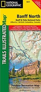
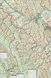
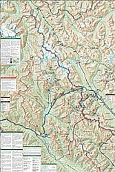 Scale 1:100,000. Size 26"x38". National Geographic edition. National Geographic's Trails Illustrated map of Banff North is a two-sided, waterproof map designed to meet the needs of outdoor enthusiasts with unmatched durability and detail. This map was created in conjunction with local land management agencies and is loaded with valuable recreation information. The front side of the Banff North map details the south side of the national park, from Siffleur Wilderness Area to the north, to Kootenay National Park to the south. This side also covers survival tips, area trails, entry fees and details both Kootenay and Yoho Nationals Parks. The reverse side of the map details the north side of the park, extending from Siffleur Wilderness area to the south, to White Goat Wilderness to the North. Insets show safe travel in Bear Country, and all the recreation the park has to offer with backpacking, camping, biking, hiking and horseback riding. Trails Illustrated maps are expertly researched and frequently updated. The maps are printed in the United States on durable synthetic paper, making them waterproof, tear-resistant, and trail tough—capable of going anywhere you do. Key Features: Waterproof and tear-resistant Clearly marked trails for hiking, biking, horseback riding, ATV, and more Detailed topography and clearly defined, color-coded boundaries of state parks, national recreation areas, wilderness areas, marine sanctuaries, and wildlife refuges Hundreds of points-of-interest, including scenic viewpoints, campgrounds, boat launches and canoe carry downs, swimming areas, fishing access points, and more UTM and Latitude/Longitude grid, as well as selected waypoints and a scale bar for easy and accurate navigation Detailed road network Useful travel information on parks and key trails Important safety information and tips Information about local organizations and land management agencies
 - $12.95
Item Code : MART21348
MapArt edition. Laminated province road maps. Longlasting, ideal for wet or muddy conditions. - $12.95
Item Code : MART21386
MapArt edition. - $12.95
Item Code : GEMT4664
 Scale 1:70,000. Size 27"x39". Gem Trek edition.
 -
Bragg Creek and Sheep Valley Road and Topographic Tourist Map, British Columbia and Alberta, Canada.
$12.95Item Code : GEMT4665
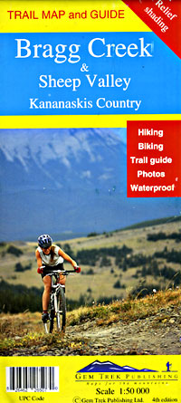
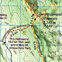 Scale 1:50,000. Size 27"x39". Gem Trek edition.
 - $12.95
Item Code : MART4682
 Scale 1:31,000. Size 19"x26". MapArt edition. Laminated.
 - $17.95
Item Code : ITMB4666
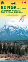
 Scale 1:250,000. Size 27"x39". International Travel Maps edition. This map covers The Canadian Rockies around Banff, kootenay and Yoho parks. The map is double sided and bring together 4 topographic maps. You can see the spectacular mountain range thanks to the elevation lines and organize your journey in the region for a road trip or a recreational stop in one of the many attractions that the Rockies have to offer. Legend shows view points recreation sites, picnic area, camping, accommodations hiking, canoeing, climbing sites, golf, fishing, tourist information and more.
 - $16.95
Item Code : NATL21061
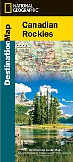 Scale 1:710,000. Size 26"x38". National Geographic edition. National Geographic’s Canadian Rockies Destination Map strikes the perfect balance between map and guidebook and is an ideal resource for touring this culturally and geographically unique region. Canada’s share of the Rocky Moutains averages approximately 100 miles across (160 kilometers) and runs from Waterton Lakes National Park on the Alberta-Montana border northwest toward the Yukon territory. The front side of the Canadian Rockies Destination Map reveals a map of the Alberta-British Columbia border region in the range’s southern half, which is home to the many beautiful and accessible parks for which the Canadian Rockies are famous. Jasper, Banff, Yoho, Glacier, and Kootenay National Parks are featured as well as a comprehensive road network including the Trans-Canada highway and Icefields Parkway. Indian reserves, provincial parks, protected and natural areas, wilderness, and recreation areas are featured on the map. Photographs highlight points of interest including the Fairmont Chateau Lake Louise, Athabasca Glacier, Natural Bridge, and Cave and Basin Natural Historic Site. The reverse side of the map provides invaluable content for travelers, including a chart and important information regarding Banff, Glacier, Jasper, Kootenay, Mount Revelstoke, Waterton Lakes, and Yoho National Parks. Visitor resources including airports, buses and shuttles, railways and parks and camping services are featured as well as information on weather, geology, wildlife, history and culture, and outdoor recreation opportunities including hiking, climbing and winter sports.
 - $12.95
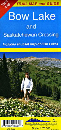
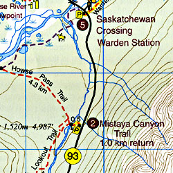
Item Code : GEMT4667
 Scale 1:50,000. Size 27"x36". Gem Trek edition.
 - $12.95
Item Code : GEMT4668

 Scale 1:35,000. Size 18"x24". Gem Trek edition.
 - $36.95 + $6.80 p&h or $18.80 foreign delivery
Item Code : MSIO4658
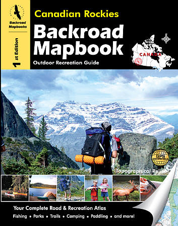
 Scale 1:200,000. Size 8?"x11". 144 pages. Mussio Ventures Ltd edition. Welcome to second special edition of the Backroad Mapbook for Canadian Rockies. This book focuses on the Canadian Rocky Mountain Parks system, an interconnected system of provincial and national parks covering more that 30,000 square kilometres–about the size of Belgium. From the world famous Banff National Park to the much quieter and smaller Elk Lakes Provincial Park there is a lifetime of recreation to enjoy in this spectacular area. If you are a follower of the series, you will notice a different twist to the book. Rather than split up the book by various activities (fishing, paddling, trails, etc.), this book focuses on the individual parks in the area as well as Kananaskis Country and the Forestry Trunk Areas of Alberta that are found in the Rocky Mountain Foothills to the east. By focusing on each park we are able to provide more details than ever before. Of course we include our ever-popular maps as well as a few helpful inset maps to help guide the people to the places we write about.
 - $24.95 + $7.50 p&h or $28.50 foreign delivery
Item Code : MART21359
Various scales. Size 9"x 12". MapArt edition. index mapped area includes Aidire, Banff, Black Diamond, Bragg Creek, Calgary, Canmore, Chestermere, Cochrane, Crossfield, High River, Irricana, Okotoks, Redwood Meadows, Strathmore, Turner Valley, and more. - $14.95
Item Code : GMJO7324
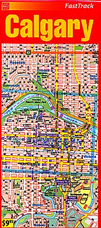
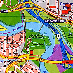
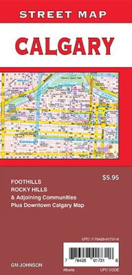 Scale 1:31,000. Size 27"x39". G.M. Johnson edition. This Map Coverage Calgary, Foothills, Rocky Hills, Downtown Calgary Map.
 - $12.95
Item Code : MART4683
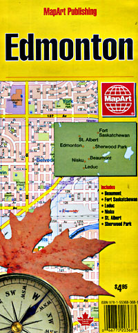
 Scale 1:32,000. Size 27"x40". MapArt edition. Includes city street plans of St. Albert, Sherwood Park, and Fort Saskatchewan. City street map.
 - $12.95
Item Code : MART4684
 Scale 1:31,000. Size 11"x24". MapArt edition. Laminated
 - $24.95 + $6.80 p&h or $18.80 foreign delivery
Item Code : MART21361
Various scales. Size 9"x 11". MapArt edition. Coverage includes Edmonton, Beautmont, Devon, Fort Saskatchewan, Leduc, Nisku, St.Albert, Sherwood park, Spruce Grove, Stony Plain and more. - $12.95
Item Code : MART21396
Scale 1:25,000. MapArt edition. Detailed city street map. - $12.95
Item Code : MART21397
Scale 1:25,000. MapArt edition. Detailed city street map.
| Postage and handling is $4.40 for the first map and $1.80 for each additional map. ~ ~ ~ ~ ~ ~ Foreign delivery is $15.80 for the first map and $7.60 for each additional map. ~ ~ ~ ~ ~ ~ Canada delivery is $15.80 for the first map and $7.60 for each additional map. |
| ** Click here! to view our beautiful collection of Alberta Travel VIDEOS ** |
Alberta - Visit the Impressive Entrepreneurial Province
People from all over the world choose to live and work in Alberta because of the diverse communities, high standard of living and beautiful landscapes along with sustainability, economic growth, and job creation all makes it the Entrepreneurial province of Canada.
Alberta is the western province of Canada and is the fourth-most populous. It’s 661,848-square kilometer is enclosed by Saskatchewan in the east, by the Northwest Territories in the north, by British Columbia in the west, and by Montana in the south.
The landscape of Alberta comprises not only of mountains, prairies, deserts, coniferous forest, but also gently sloping wheat fields, vast granaries, expansive cattle ranches, and huge oil refineries.Agriculture is Alberta's economic backbone.
The largest city is Calgary and Edmonton, the capital city is the second largest.Other prominent cities are Fort McMurray, Lethbridge, Medicine Hat, Red Deer, and St. Albert.
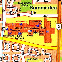
It has attractions like skiing, hiking, and camping, shopping spots like the West Edmonton Mall, Calgary Stampede the rodeo exhibition and festival as well as athletic and sporting competitions. The Elk Island National Park, Wood Buffalo National Park, and the Columbia Icefield are natural attractions.
Banff has been identified as one of the Best World Destinations for 2017 by National Geographic Traveler magazine.The Banff National Park is well-known for wildlife, its Canadian Rocky Mountain beauty, and entertainment prospects with more than four million travelers every year.
The 10,000-square km Jasper National Park is the largest wilderness park in the Canadian Rockies and is the largest easily accessible Dark Sky Preserve in the world and it is a four-hour drive from Edmonton.Visit Alberta with a map and enjoy everything the Park offers like the ‘star gazing’ experience, Sidewalk Astronomy Roves in the daytime all through summer, and interpretations in the fall like Mysteries of the Night to enhance visitors.
Alberta Road Maps for Tourists and TravelersDetailed Road Map of AlbertaBuy travel maps for Alberta tourist attractions, road trips, street guide, driving directions and more |
