
Alaska Road Maps | Detailed Travel Tourist Driving
The Unusual Mountain Calling – Alaska
It is easy to be spellbound by the beauty of the Alaskan wilderness, pristine forests, roads less traveled, secluded frontier regions and giant glaciers. It is home to breathtaking mountains and icebergs as well as active volcanoes and a diverse terrain.
Make your trip to ‘The Last Frontier’ easy with a map of Alaska to drive the 1500-mile highway and explore its towns like Haines, Homer, Ketchikan, Skagway, Sitka, Talkeetna, and Valdez.
The largest state in the US by area is Alaska, which is situated in the northwest extreme of North America and is the 3rd least populated. Denali mountain, part of the Alaska range, is the highest mountain in North America, which is located in the Denali National Park. The mountain is covered with snow and glaciers.
Alaska has poor road connections as compared to the rest of the U.S. and links the central population centers and the Alaska Highway. Juneau, the state capital, is accessible only by a car ferry, planes or cruise ships not by road. There is no road system that connects the communities in the Western part of Alaska with the rest of the country.
In Alaska, Anchorage is the largest city in terms of population, which is eight times more than the next biggest town, Fairbanks. Anchorage is well known tourist destination for sixty glaciers in the mountain ranges that are situated within 50 miles.
Fairbanks is ‘the Golden Heart of Alaska’ less than 200 miles from the Arctic Circle. It has the shortest winter day of less than three hours of sunlight and the longest summer day of 21 hours of light.
‘The First City’ Ketchikan, is the southern most city in Alaska as it is the first-place people come to when visiting Alaska. A few other things that define Alaska are Jade, Totem statues, salmon, furs, Ivory from mammoth and seals, antlers, gold and oil.
Alaska Road Maps for Tourists and TravelersDetailed Road Map of AlaskaBuy travel maps for Alaska tourist attractions, road trips, street guide, driving directions and more |
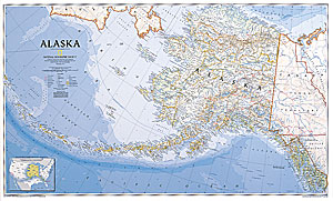
Alaska
- $34.95 + $6.80 p&h or $18.80 foreign delivery
Item Code : NATL4615

 Scale 1:3,800,000. Size 24"x38". National Geographic edition. Laminated. Rolled.
 - $24.95 + $6.80 p&h or $18.80 foreign delivery
Item Code : NATL4616
 Scale 1:3,800,000. Size 24"x38". National Geographic edition. Rolled. Not laminated.
 - $249.95 + $24.80 p&h (add $40 for spring rollers)
Item Code : UNIV4614
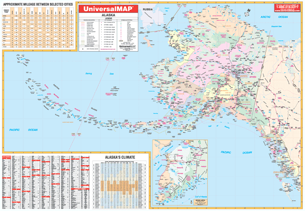 Scale 1:260,000. Size 64" W x 45" H. Laminated. Printed in color with a markable/washable-laminated surface. Cities and counties are indexed on the face of the map. Has hanging rails mounted top and bottom. Features color-coded counties, a mileage chart between major cities, and inset maps of Kenai area and a climate chart by month. Details include all state and federal highways, secondary roads, cities and towns, major airports, county names, state universities, military installations, major waterways, wildlife areas, state/national parks, time zones, and points of interest. Railed wall maps can be turned into pull down maps on spring rollers for an additional $40.
 - $17.95
Item Code : TRAL4621
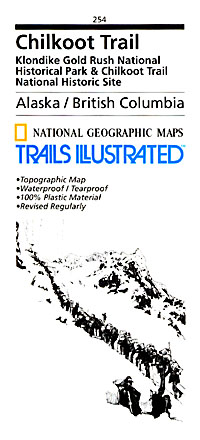
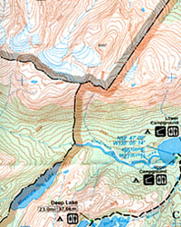 "Various scales". Size 25"x37". Trails Illustrated edition. This Trails Illustrated map for Chilkoot Trail/Klondike Gold Rush National Historic Park in the Alaskan panhandle and surrounding area is perfect for hiking, camping, and wildlife viewing in this scenic, rugged frontier. Includes UTM tick marks for use with your GPS unit. This two-sided map includes Chilkoot Trail National Historic Site, portions of the Klondike Highway, Chilkoot Trail, Chilkoot Pass/Parks Canada Warden Station, Happy Camp, Deep Lake, Lindeman City, Bare Loon Lake, Bennet, Crater Lake, Long Lake, Lindeman Lake, Bennett Lake, Summit Lake, Taiya Inlet, the town of Skagway, Klondike Gold Rush National Historical Park, Denver Glacier Trail, Skagway River, Dyea, and more.
 - $11.95
Item Code : RAND4640
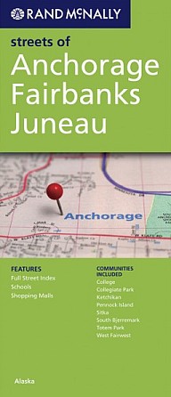 Scale 1:28,000. Size 26"x36". Rand McNally edition. Communities include: College, Collegiate Park, Ketchikan, Pennock Island, Sitka, South Bjerremark, Totem Park, and West Fairwest.
 - $17.95
Item Code : TRAL4622
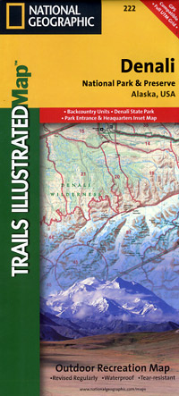
 McKinley), Alaska, America. Scale 1:225,000. Size 26"x37". Trails Illustrated edition. Denali National Park, in the Alaska Range, is crowned by Mount McKinley—America’s highest peak at 20,320 feet. The map includes the entire national park area, with a close-up view of the area in and around Mount McKinley. It also includes useful tips about animal encounters, river crossings, hypothermia, and UTM grids for use with your GPS unit.
 - $10.95
Item Code : RAND4641
Rand McNally edition. Detailed city street map. - $17.95
Item Code : TRAL4623
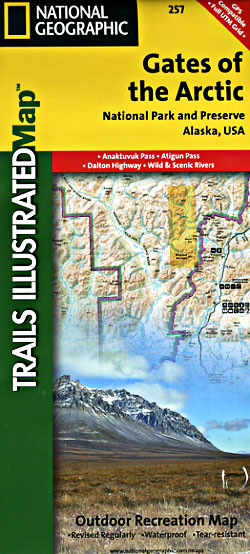
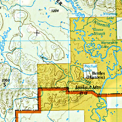 Scale 1:400,000. Size 26"x38". Trails Illustrated edition. This Trails Illustrated map for Gates of the Arctic National Park and Preserve and surrounding area in northern Alaska is perfect for hiking, camping, exploring, photography, and wildlife viewing in this stunning expanse. This two-sided map includes Gates of the Arctic National Park and Preserve, portions of Noatak National Preserve, Kanuti National Wildlife Refuge, Selawik National Wildlife Refuge, and Yukon Flats National Wildlife Refuge. Also included are Anaktuvuk Pass, Mount Ingstad, the Arctic Interagency Visitor Center, South Fork Koyukuk River, Grayling Lake, Marion Creek Campground, the Endicott Mountains, Noatak Wild and Scenic River, and more. The second side of the map features a beautiful map of Alaska with all of its national parks and preserves, as well as detailed information about Gates of the Arctic National Park and Preserve, trip planning tips, and backcountry activities and safety information. Includes UTM grids for use with your GPS unit.
 - $17.95
Item Code : TRAL4624
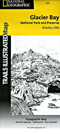
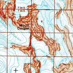 Scale 1:250,000. Size 26"x38". Trails Illustrated edition. This Trails Illustrated map for Glacier Bay National Park, Glacier Bay National Preserve, and surrounding area in Alaska's panhandle is perfect for hiking, camping, boating, paddling, and wildlife viewing in this scenic, rugged frontier. Includes Glacier Bay National Park, Glacier Bay National Preserve, Glacier Bay Wilderness, portions of Tongass National Forest, Chicagof Island, Endicott River Wilderness, Haines State Forest and Resource Management Area, Chilkat State Park, Chilkat Islands, Sullivan Island State Marine Park, Pleasant Island, Lemesurier Island, Inian Islands, and Tatshenshini Alsek Park. Waterways include the Gulf of Alaska, Glacier Bay, Cross Sound, Icy Strait, Lynn Canal, Johns Hopkins Inlet, Scidmore Bay, and more. Natural features include the Fairweather Range, Brady Glacier, St. Elias Mountains, Takhins Mountains, McBride Glacier, and more. Includes UTM tick marks for use with your GPS unit.
 - $17.95
Item Code : TRAL4626

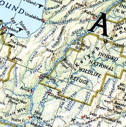
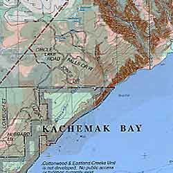 Scale 1:1,000,006. Size 26"x37". Trails Illustrated edition. This Trails Illustrated topographic map is the most comprehensive recreational map for Alaska's Kachemak Bay State Park area. Coverage includes: Kachemak Bay State Park and Kachemak Bay State Wilderness Park; Kenai National Wildlife Refuge; Kenai Fjords NP; Kenai Wilderness; Crooked Creek; Stariski State Recreation Site; Ninilchik and Clam Gulch State Recreation Area; Tustumena Lake; Anchor River; Deep Creek Recreation Area, and much more. Includes UTM tick marks for use with your GPS unit.
 - $17.95
Item Code : TRAL4627
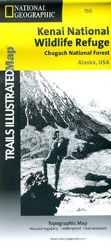
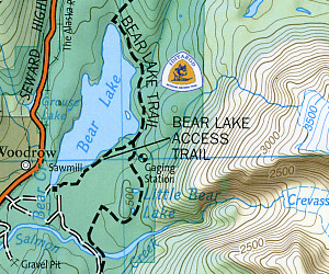
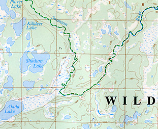 Scale 1:105,600 . Size 26"x37". Trails Illustrated edition. This Trails Illustrated topographic map is the most comprehensive and complete recreational map for Alaska's Kenai National Wildlife Refuge/Chugach National Forest area. Coverage includes Chugach National Forest, Kenai National Wildlife Refuge and Wilderness, Soldotna and Sterling; Skilak, Tustumena and Kenai lakes, Turnagain Arm. Detail maps of the Swanson River and Swan Lake canoe routes. Resurrection, Johnson and Moose passes, and Seward Highway Scenic Byway. Includes rated mountain bike trails.
 - $17.95
Item Code : TRAL4628
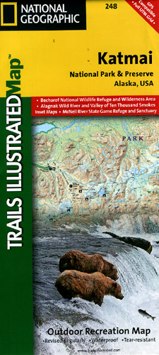
 Scale 1:300,000. Size 26"x38". Trails Illustrated edition. This two-sided map features Katmai National Park and Wilderness in its entirety, Becharof National Wildlife Refuge, and Wilderness Area, Alaska Peninsula National Wildlife Refuge, Alagnak Wild River Katmai National Preserve, McNeil River State Game Refuge and Sanctuary, Iliamna Lake, Kukaklek Lake, Naknek Lake, Kvichak Bay, Becharof LAke, Upper Ugashik Lake, Puale Bay, Katmai Bay, and the Shelikof Strait. The map also inlcudes Wilderness Safety tips, land use regulations, and information on how best to react to bear encounters. Beautiful cartography shows the mountains, rivers, marsh areas, and natural features of this spectacular land. UTM tick marks for use with your GPS unit are also provided.
 - $17.95
Item Code : TRAL4629

 Scale 1:106,000. Size 25"x37". Trails Illustrated edition.
 - $17.95
Item Code : TRAL4631
Scale 1:105,600. Trails Illustrated edition. Coverage includes Chugach National Forest, Kenai National Wildlife Refuge and Wilderness, Soldotna and Sterling; Skilak, Tustumena and Kenai lakes, Turnagain Arm. Detail maps of the Swanson River and Swan Lake canoe routes. Resurrection, Johnson and Moose passes, and Seward Highway Scenic Byway. Includes rated mountain bike trails. - $17.95
Item Code : TRAL4633
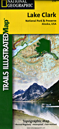
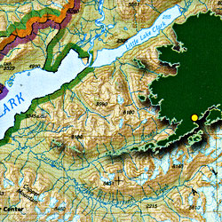 Scale 1:135,000. Size 25"x37". Trails Illustrated edition. This two-sided map includes Lake Clark National Park and Preserve in its entirety, McNeil River State Game Refuge, Tuxedni Wilderness, and portions of Katmai National Preserve. The map includes the towns of Port Alsworth, Iniskin, Dutton, Old Iliamna, Pile Bay Village, Pedro Bay, Chekok, Iliamna, Newhalen, Kokhanok, Chinitna Bay, Chenik, and Drift River. Natural features include Lake Clark, Iliamna Lake Cook Inlet, Kamishak Bay, Ursus Cove, Augustine Island, Telaquana Lake, Twin Lakes, Turquoise Lake, Chakachamna Lake, Snipe Lake, the Neacola Mountains, Chigmit Mountains, Aleutian Range, Tanalian Mountain, Tanalian Falls Trail, Copper Mountain, Kontrashibuna Lake, Currant Creek and much more. The map includes historic information about the park, information on trip planning, permits, backpacking, float trips/rafting, hunting and fishing, phone numbers for more information, and backcountry safety tips. Includes UTM tick marks for use with your GPS.
 - $17.95
Item Code : TRAL4637
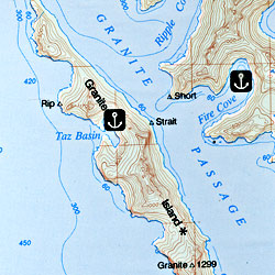
 Scale 1:110,000. Size 26"x38". Trails Illustrated edition. This Trails Illustrated topographic map is the most comprehensive recreational map for Alaska's Prince William Sound - West area. Coverage includes Chugach National Forest, Nellie Juan-College Fjord Wilderness Study Area, Granite Bay, South Esther Island, Surprise Cove, Decision Point, Entry Cove, Ziegler Cave and Bettles Bay state marine parks. Whittier and Chenega. Knight, Latouche, Elrington, Evans, Bainbridge, Culross, Esther and Perry islands; Port Wells, Port Nellie Juan and Port Bainbridge; Harriman, College and Blue fjords. Includes selected anchorages and kayak landings.
 - $17.95
Item Code : TRAL4638
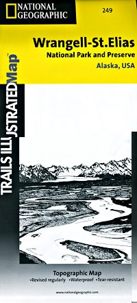
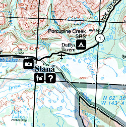 Elias National Park, Road and Recreation Map, Alaska, America. Scale 1:375,000. Size 26"x38". Trails Illustrated edition. This Trails Illustrated topographic map is the most comprehensive recreational map for Alaska's Wrangell - St. Elias National Park & Preserve area. This two-sided map covers Wrangell - St. Elias National Park in its entirety, along with Tetlin National Wildlife Refuge, portions of Chugach National Forest, the Bering Glacier, Kayak Island State Marine Park, Robinson, Chugach, and Wrangell Mountains. Towns include Katalla, Mt. Hazelet, Cape Yakataga, Kennicott, McCarthy, Slana, and Glennallen. The map features two detailed insets: the first includes Yakutat Bay, Disenchantment Bay, Russel Fjord, Nunatak Fjord, and Malaspina Glacier; the second shows the Kennicott and McCarthy areas, Bonanza Ridge, Fireweed Mountain, and the Nizina River.
 - $10.95
Item Code : UNIV4607
 Scale 1:3,700,000. Size 27"x40". Universal Map edition.
 - $14.95
Item Code : GMJO2548
Size 26”x19”. G.M Johnson Maps edition. This Map includes Juneau, Ketchikan, Sitka, Port Hardy, Port McNeill, Prince Rupert City Maps and Seattle, Vancouver, Vancouver Island, Glacier Bay, Seward & Ports of Call. -
| Postage and handling is $4.40 for the first map and $1.80 for each additional map. ~ ~ ~ ~ ~ ~ Foreign delivery is $15.80 for the first map and $7.60 for each additional map. ~ ~ ~ ~ ~ ~ Canada delivery is $15.80 for the first map and $7.60 for each additional map. |
| ** Click here! to view our beautiful collection of Alaska Travel VIDEOS ** |
The Unusual Mountain Calling – Alaska
It is easy to be spellbound by the beauty of the Alaskan wilderness, pristine forests, roads less traveled, secluded frontier regions and giant glaciers. It is home to breathtaking mountains and icebergs as well as active volcanoes and a diverse terrain.
Make your trip to ‘The Last Frontier’ easy with a map of Alaska to drive the 1500-mile highway and explore its towns like Haines, Homer, Ketchikan, Skagway, Sitka, Talkeetna, and Valdez.
The largest state in the US by area is Alaska, which is situated in the northwest extreme of North America and is the 3rd least populated. Denali mountain, part of the Alaska range, is the highest mountain in North America, which is located in the Denali National Park. The mountain is covered with snow and glaciers.
Alaska has poor road connections as compared to the rest of the U.S. and links the central population centers and the Alaska Highway. Juneau, the state capital, is accessible only by a car ferry, planes or cruise ships not by road. There is no road system that connects the communities in the Western part of Alaska with the rest of the country.
In Alaska, Anchorage is the largest city in terms of population, which is eight times more than the next biggest town, Fairbanks. Anchorage is well known tourist destination for sixty glaciers in the mountain ranges that are situated within 50 miles.
Fairbanks is ‘the Golden Heart of Alaska’ less than 200 miles from the Arctic Circle. It has the shortest winter day of less than three hours of sunlight and the longest summer day of 21 hours of light.
‘The First City’ Ketchikan, is the southern most city in Alaska as it is the first-place people come to when visiting Alaska. A few other things that define Alaska are Jade, Totem statues, salmon, furs, Ivory from mammoth and seals, antlers, gold and oil.
Alaska Road Maps for Tourists and TravelersDetailed Road Map of AlaskaBuy travel maps for Alaska tourist attractions, road trips, street guide, driving directions and more |
