
Afghanistan Road Maps | Detailed Travel Tourist Driving
A Map Organizes a Wonder – Afghanistan
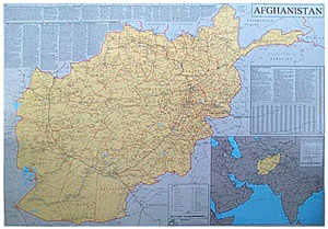
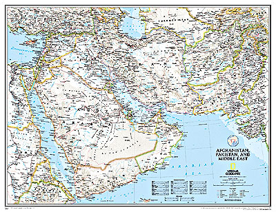
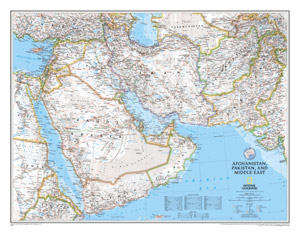
The unknown country, Afghanistan is an Asian country sharing land borders with 6 countries: Iran, Turkmenistan, China, Pakistan, Tajikistan, Uzbekistan. It covers 652,230 square kilometers of land. The capital of Afghanistan is Kabul, which is the political center and home to its Executive head of state.
Mapping Afghanistan
We are on a mission to map Afghanistan as many people often associate it with war, terrorism, and Taliban. The map of Afghanistan will make you realize that it is just as beautiful with rivers, mountains, valleys, and plateaus.
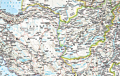
Most of Afghanistan is encompassed by high snow-capped mountains while deep valleys traverse its terrain and the Helmand River which is the largest. While,Oxus or Amu River is the border river, formed by the union of the Pamir River and the Vakhsh river.
The highest peak in Afghanistan is the Noshaq mountain and the Hindu Kush is the highest mountain range. The southern and western parts of Afghanistan are covered by desert lands. Afghanistan’s main source of income is through agriculture. It grows fruits, vegetables, nuts and Poppy which is cultivated in numerous parts of the country, especially the Helmand river valley in the southern region.
A special part of the Afghan culture has been poetry and in the western city of Herat people listen to traditional Herati music, drink sweet tea and pastries all night on Thursdays. The citadel was built by Alexander the Great in 330BC.
If you are planning to visit Afghanistan, you will see the landlocked country has some of the most beautiful cities with a rich history and culture to share with the world like Bamyan, Ghazni, Band-e-Amir National Park, Blue mosque, the endangered cultural site Balkh (Mother of Cities), Kandahar (the heart of Afghanistan), and Kabul to name a few.Afghanistan today is an unlikely tourist destination and our maps will place this wonder back on the globe.
Afghanistan Road Maps for Tourists and TravelersDetailed Road Map of AfghanistanBuy travel maps for Afghanistan tourist attractions, road trips, street guide, driving directions and more |
Afghanistan
- $17.95
Item Code : ITMB4505
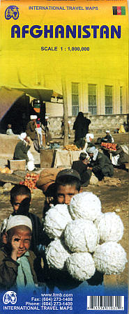
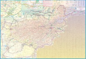
Scale 1:1,000,000. Size 27"x39". Indexed. International Travel Maps edition. This is a large-scale, double-sided map. Includes more than 4,000 cities and mountain villages. Very detailed.
Afghanistan is a lovely country, and is slowly coming out of an extremely bad situation. It is still quite an unsafe country, and fighting could flare up again in the spring. Regardless, it is a strategically important country, and one that ITMB has taken quite a bit of effort to make into a significant map. This is essentially a reprint of the previous edition. Not only is there little change occuring, but the previous edition was prepared relatively recently, so there hasn’t been enough time for change to occur. - $19.95
Item Code : REIS4506
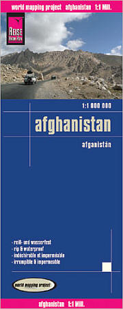
 Scale 1:1,000,000. Size 28"x36". Reis Know How edition. Very detailed Afghanistan road map. English and multi-lingual legends. Printed on tear-resistant, waterproof, paper-like plastic. It can bend and fold without cracking and is writable as normal paper, non-toxic and recyclable. Perfect for tourist adventures and independent travel and for driving tours. Includes topographic contour lines and hypsometric color tints which show height levels, along with elevation numbers. Shows all major and secondary roads and tertiary roads, with distances between points in kilometers. Fully indexed. Beautiful cartography.
 - $17.95
Item Code : NELS4504
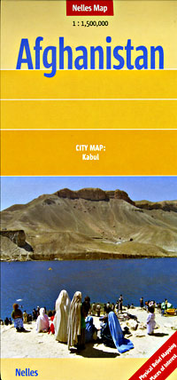
 Scale 1:1,500,000. Size 20"x31". Printed on both sides. Nelles Verlag edition. Beautiful shaded relief allows you to see the mountains and valleys, just as though you were flying over them in a plane. Shows all types of roads and tracks, road numbers, distances between points in kilometers, railways, cities, towns, and villages, mountain peaks with heights in meters, airports, places of interest, national parks, ancient sites, and ruins. Also includes an inset principal streets tourist map of Kabul. Very detailed. Laminated card cover. BIG >> SAMPLE MAP
 - $17.95
Item Code : GIZI4507
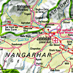
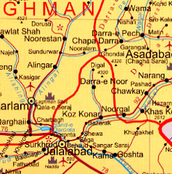
 Scale 1:3,000,000. Size 27"x36". Gizi Maps. English and multilingual text and legends. Elevation and topographic features are shown by dramatic hypsometric color tints. The map of Afghanistan is on one side of the map while the reverse has a large map of Kabul (1:35,000), plus inset maps of Herat, Jalalabad, Kabul city center (1:20,000), Kandahar, Kunduz, and Mazar-e Sharif, and index of places names for both Afghanistan and Pakistan. The map has a superb presentation of the region's topography using color shading, contour lines, and spot heights to show elevation. The map has numerous names of geographic features on the map. The road network includes six types of roads from motorways to dirt tracks. Many of the routes are numbered and distances are shown between road junctions. Symbols denote tourist sites and services on both the main map and the city maps. Legend in English plus five languages.
 - $17.95
Item Code : ITMB5505
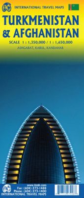
Scale 1:350,000/1:1,650,000. Size 27"x39". 4th Edition. International Travel Maps.
The world is changing as a result of a global pandemic, and ITMB has to change with it. We wish to keep all of our artwork available, but at a time of greatly reduced travel, we have been forced to combine two different countries that share a common border in order to justify printing either one. The two countries, Afghanistan and Turkmenistan, do share a common heritage, but a very different history.
ITMB Publishes a separate map of the country, and a map of Kabul. The reason for this map is that it is our first ever map of just Turkmenistan, a former part of the USSR that broke away in the collapse of the Russian empire in 1990. The country has, however, not emerged from the Soviet way of thinking, and is authoritarian in its attitude. It is, fortunately, open to travel, and is slowly improving its facilities, so is to be encouraged. The map includes a very good inset map of Ashgabat, the capital.
The country stretches from the Caspian Sea to the Uzbek border and from Russia south to Iran and Afghanistan. We have also added eight Top Attractions, ranging from the World Heritage site of Konye to the ancient ruins of Nisa. We previously published this titles as part of a regional map of the ‘Stans’, but growing demand has justified its own map. We have also published a separate map of Uzbekistan and a separate three-country map of the other three countries, all of which are showing strong signs of touristic development. Turkmenistan is a country emerging as a future travel Mecca.
- $17.95
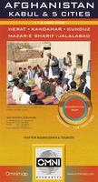
Item Code : ITMB5507
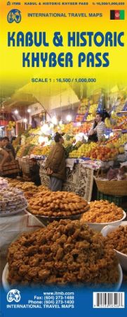
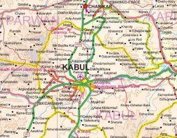
Scale 1:16,500. /1:1,100,000. Size 27"x39". International Travel Maps edition.
Never let it be said that ITMB is a shrinking violet! Well, those who think Afghanistan is a perpetual basket case had better think again. Sure, the country is still infested with tribal factions (it always has been), and fighting still occurs all too often, but if one wants to get in on the groundswell of a new day, one starts early.
This is the first map of Kabul that’s ever been published by a major cartographic house. Is it a good map? Well, I hope so. Obviously, doing the research was a bit difficult, but it is the best darned map on the market and will appeal to aid agencies, relief workers, the families of tens of thousands of soldiers who are posted to the region, and to the rebuilders who are steadily and quietly rebuilding the new Afghanistan.
It isn’t all doom and gloom; there’s some exciting things happening in Afghanistan that are positive, like the rebuilding of the medieval fortress overlooking Heart, or the first council of elders that was held in Kabul very recently.
- $34.95 Rolled + $8.80 p&h or $36.80 foreign delivery
Item Code : AYAZ4509
 Scale 1:1,500,000. Size 28"x40". Ayazi Publishing. This is by far, the largest-scale and most detailed wall map of Afghanistan showing the road system.
 - $26.95 Rolled + $8.80 p&h or $36.80 foreign delivery
Item Code : NATL4511
 Scale 1:3,800,000. Size 20"x31". National Geographic edition. Excellent shaded relief show the topography of Afghanistan. Not laminated.
 - $34.95 Rolled + $8.80 p&h or $36.80 foreign delivery
Item Code : NATL4510
 Scale 1:3,800,000. Size 20"x31". National Geographic edition. Laminated. Excellent shaded relief shows the topography of Afghanistan.
| ** Click here! to view our collection of Afghanistan Maps ** |
| Postage and handling is $4.40 for the first map and $1.80 for each additional map. ~ ~ ~ ~ ~ ~ Foreign delivery is $15.80 for the first map and $7.60 for each additional map. ~ ~ ~ ~ ~ ~ Canada delivery is $15.80 for the first map and $7.60 for each additional map. |
A Map Organizes a Wonder – Afghanistan
The unknown country, Afghanistan is an Asian country sharing land borders with 6 countries: Iran, Turkmenistan, China, Pakistan, Tajikistan, Uzbekistan. It covers 652,230 square kilometers of land. The capital of Afghanistan is Kabul, which is the political center and home to its Executive head of state.
Mapping Afghanistan
We are on a mission to map Afghanistan as many people often associate it with war, terrorism, and Taliban. The map of Afghanistan will make you realize that it is just as beautiful with rivers, mountains, valleys, and plateaus.
Most of Afghanistan is encompassed by high snow-capped mountains while deep valleys traverse its terrain and the Helmand River which is the largest. While,Oxus or Amu River is the border river, formed by the union of the Pamir River and the Vakhsh river.
The highest peak in Afghanistan is the Noshaq mountain and the Hindu Kush is the highest mountain range. The southern and western parts of Afghanistan are covered by desert lands. Afghanistan’s main source of income is through agriculture. It grows fruits, vegetables, nuts and Poppy which is cultivated in numerous parts of the country, especially the Helmand river valley in the southern region.
A special part of the Afghan culture has been poetry and in the western city of Herat people listen to traditional Herati music, drink sweet tea and pastries all night on Thursdays. The citadel was built by Alexander the Great in 330BC.
If you are planning to visit Afghanistan, you will see the landlocked country has some of the most beautiful cities with a rich history and culture to share with the world like Bamyan, Ghazni, Band-e-Amir National Park, Blue mosque, the endangered cultural site Balkh (Mother of Cities), Kandahar (the heart of Afghanistan), and Kabul to name a few.Afghanistan today is an unlikely tourist destination and our maps will place this wonder back on the globe.
Afghanistan Road Maps for Tourists and TravelersDetailed Road Map of AfghanistanBuy travel maps for Afghanistan tourist attractions, road trips, street guide, driving directions and more |
