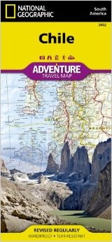
Chile Adventure Road and Tourist Map.
$16.95
In stock
Scale 1:1,750,000. Size 26"x38". National Geographic edition. National Geographic s Chile AdventureMap is designed to meet the unique needs of adventure travelers detailed, durable, and accurate. Our map shows the locations of thousands of major cities and towns with an index to easily locate them, and a clearly marked road network complete with distances and designations for major highways, toll roads, limited access highways, and more.
What sets National Geographic AdventureMaps apart from traditional road maps are the hundreds of points of interest that highlight the diverse, unique, and exotic destinations within Chile. The map includes national parks and preserves, World Heritage sites, archaeological sites, ski areas, beaches, waterfalls, natural points of interest, and important travel aids like airports, airstrips, rail lines, lighthouses, border crossings, and harbors.
The north side of our Chile map covers the Peruvian border south to Concepción, and includes the cities of Santiago, La Serena, Arica, and Chanaral; and the Atacama Desert. Inset maps provide detail for Easter Island, Archipiélago Juan Fernandez, and the San Felix and San Ambrosio Islands. The south side overlaps with the north and covers the remainder of the country to Cape Horn at the southernmost tip, rich with national parks. Some of the major cities included on this side are Punta Arenas, Concepción, Puerto Montt, and Coihaique.
Our Chile AdventureMap is printed in the U.S. on a durable synthetic sheet, making it waterproof, tear-resistant, and capable for withstanding any condition Mother Nature can dish out. It is printed on both sides, and folded to an easily packable size of 4.25 x 9.25. Unfolded size is 26 x 38.
Net proceeds from the sale of this map go to support the nonprofit mission of the National Geographic Society.
| Item Price | $16.95 |
|---|
Write Your Own Review


